The 5 Best Walks in Switzerland's Famous Jungfrau Region
Looking for the absolute best Jungfrau Region walks for 2025? Look no further. We share our five favorite walks from leg burners to casual strolls through some of Switzerland and the world's most iconic scenery.
THE BEST OF HIDDEN SWITZERLANDDISCOVERING BERN
Just a heads-up! We include affiliate links in some of our posts. If you click the link and decide to make a purchase, we may earn a small commission at absolutely no extra cost to you. It’s a way for us to keep providing you great guides to Switzerland's amazing off the beaten path destinations
Welcome To A Hikers Paradise
Without a doubt, Switzerland’s Jungfrau Region is one of the most popular destinations in the country for foreign visitors. Last year alone, over one million(!) people found their way to its iconic mountain-top station at Jungfraujoch.
That is a lot of people paying a whole lot of money (more than 100 CHF per person) to head up to a single peak!
That said, over the last year, we have found that you don’t have to go very far out of your way to escape the crowds, save your pocketbook, and enjoy some of the same incredible views in the Jungfrau Region. That even applies at its busiest times of year.
The Jungfrau Region is a paradise for walkers and hikers and heading out on the trail is the absolute best way to escape the crowds. This week, we share 5 of our favorite walks in the Jungfrau Region. From easy strolls to challenging day hikes there is a ton of variety with something for everyone.
Whether you are just heading up for the day from Interlaken or staying somewhere around the Jungfrau, all of these trips are easily accessible by public transit and do-able in less than a day. Each offers incredible views (weather dependent of course) and the chance to experience some of the best scenery in all of Switzerland.
Thanks for joining us!
Jump straight to a walk using the link below or keep reading to see them all!
Best for a light stroll - Lauterbrunnen to Stechelberg
Best for views - The Mountain View Trail from Grütschalp to Allmendhubel
Best if you are short on time - The Kleiner Rugen Ringweg
Best bang for your buck - Männlichen to Wengen via the Panorama Trail
Best for a workout - The Eiger Trail from Alpiglen to Eigergletscher
The Best For A Light Stroll
Lauterbrunnen to Stechelberg - 8 kilometers (5 miles) - 100 m (330 ft) elevation gain - Adjust the distance to your taste using the bus.
The view looking up the Lauterbrunnen Valley towards Stechelberg
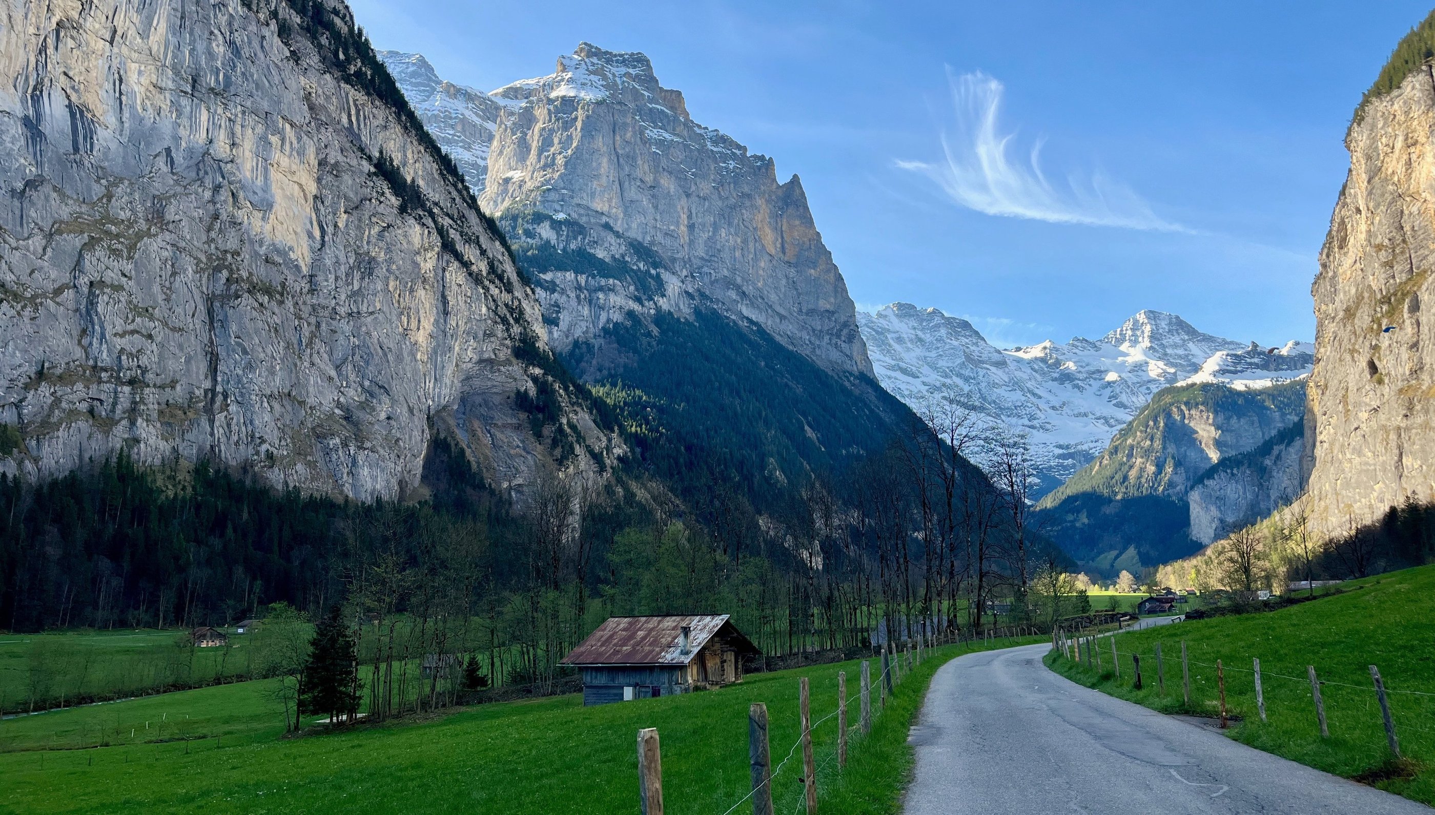
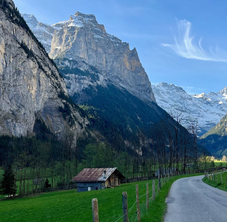
If you are looking for a relatively flat path that escapes the crowds and offers infinite customizability, you will want to check out the valley walk from Lauterbrunnen to Stechelberg. While this walk comes in at a total of about 8 km’s (5 miles), its length is easily adjusted by making use of Bus 141 which regularly traverses the bottom of the valley. The walk's relatively tame 100 meters or about 330 ft of elevation gain makes for a pleasant stroll without too much sweating.
The walk starts at the main train station in the village of Lauterbrunnen, and makes its way through town to the world famous Staubach Falls. While this section can be a bit busy, especially in the height of summer, the crowds quickly thin out the further you go.
Past Staubach, the partially paved path meanders through the bottom of the Lauterbrunnen Valley past farm houses and many of valley’s 72 waterfalls, eventually passing straight under the brand new (world’s steepest) gondola between the outskirts of Stechelberg and Mürren. At the end of your walk, just a couple kilometers beyond the gondola station in the hamlet of Stechelberg, make sure to stop in at the Hotel Stechelberg for a piece of their excellent Schwarzwälder Torte, or Black Forest Cake before catching the bus back to Lauterbrunnen.
If you are looking to get a bit more of a workout in, continue up valley past Stechelberg to some incredible waterfalls and more rugged terrain. Alternatively, if you are interested in the least amount of effort possible, take the bus from Lauterbrunnen straight to Hotel Stechelberg and work your way back to Lauterbrunnen. The views are still excellent, and you will be heading downhill most of the way.
For more information check out the detailed walking guide in our Into the Alps Series.
P.S. This route is also open in the winter for both walking and cross-country skiing and it is simply magical in the snow. Just be sure to stick to the correct path so you don’t inadvertently end up on the ski loop if you are walking or vice versa.
The Best for Views
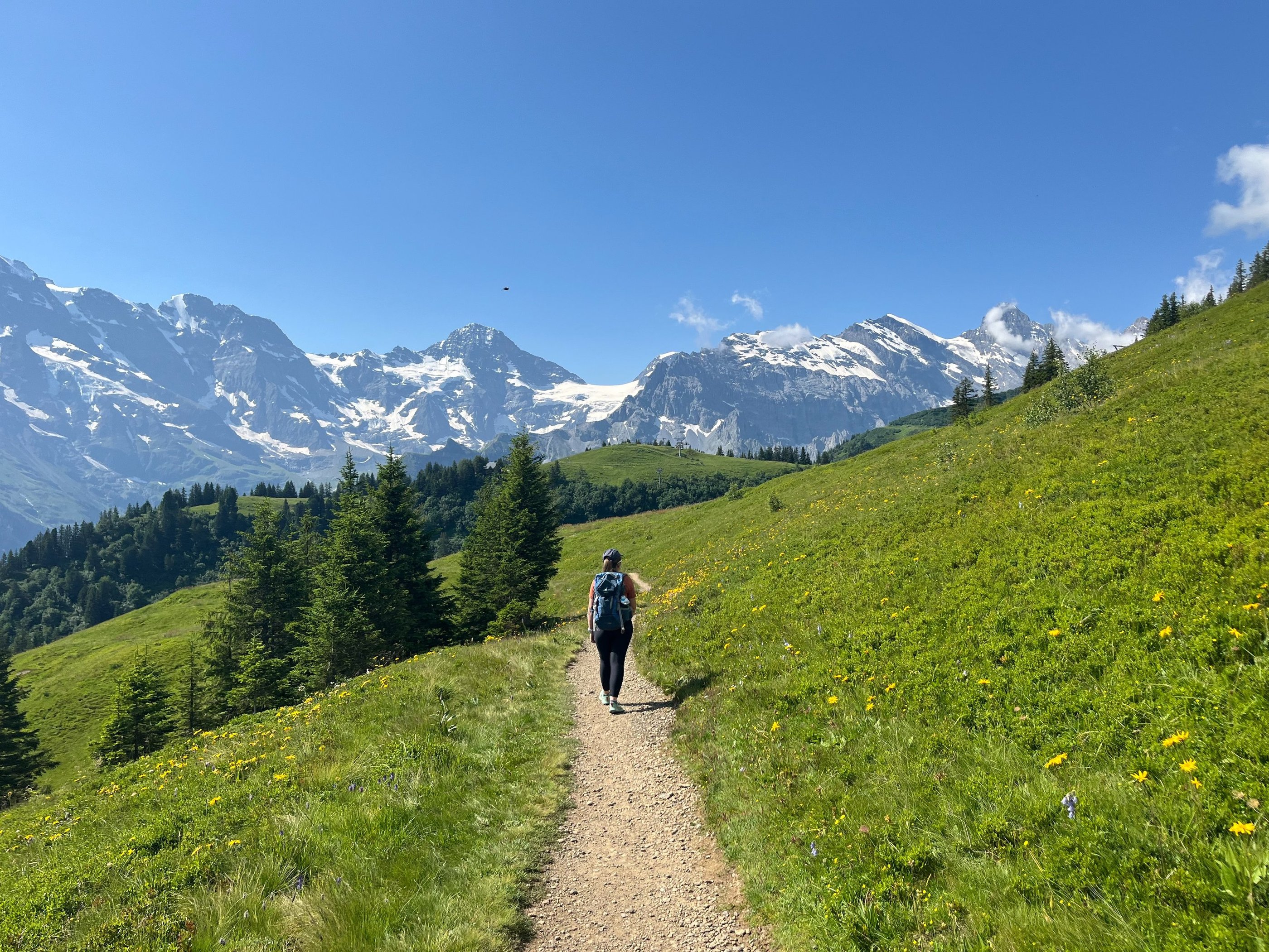
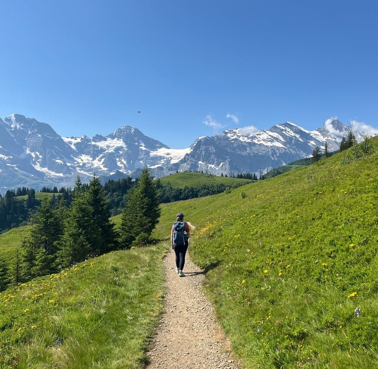
The Mountain View Trail from Grütschalp to Allmendhubel - 5 km (3 miles) - 520 meters (1700 feet) of Elevation Gain - Add on another 3 km's of downhill walking to go all the way to Mürren
If you are looking for the absolute highest density of good views in the Jungfrau Region, without a doubt, the Mountain View trail between Grütschalp and Allmendhubel is one of your best bets. From Lauterbrunnen a quick gondola ride brings you to Grütschalp. While most people will continue on the train to Mürren from here, the station is the start of your walk.
Two paths fork off just beyond Grütschalp Station, the lower path parallels the train line while the upper path climbs up through the forest. If you choose the mare challenging 5 km (3 mile) upper path, you will be exceptionally well rewarded.
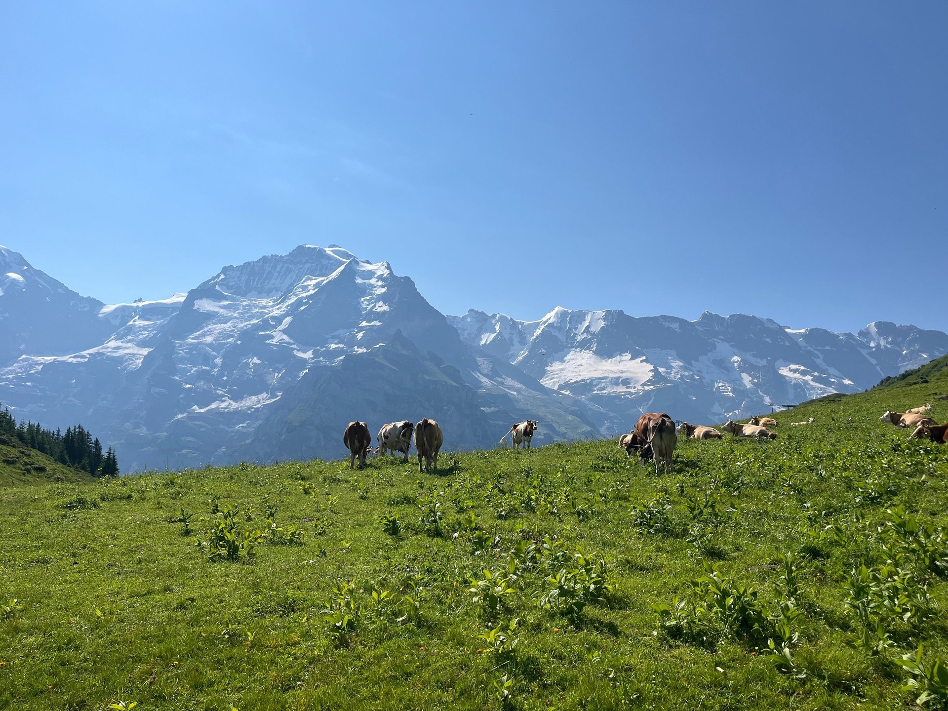
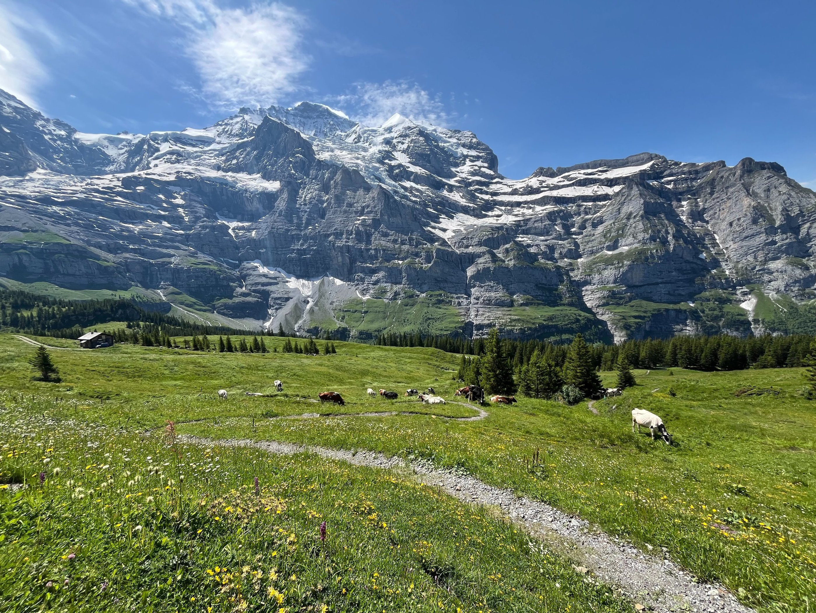
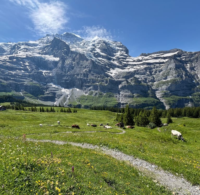
After a couple kilometers of uphill, the alps open up, the elevation evens out, and the stunning views of the Bernese Alps improve all the way to Allmendhubel just above Mürren. More than likely, you will share portions of this path with Switzerland’s resident dairy cows making for a truly Swiss experience.
From Allmendhubel you can take the funicular back down to Mürren or hike down by way of Sonnenberg (our preference). The hike will add in about 3 km’s or 2 miles but it’s almost entirely downhill and offers a plethora of good views out on the Jungfrau and, eventually, down the Lauterbrunnen Valley.
From Mürren, the world is your oyster with hiking tracks, gondolas, and trains heading off in nearly every direction making this walk an excellent starting point for your onward adventures.
For more information, check out our detailed walking guide to the Mountain View Trail in our Discovering Bern Series.
The Mountain View Trail between Grütschalp and Allmendhubel
The Best If You Are Short On Time
The Kleiner Rugen Ringweg – 3.5 km (2 miles) - 84 meters (275 ft) of Elevation Gain - Castle Ruins and a Brewery just a short walk away.
Views of Jungfrau from the Trinkhalle on Kleiner Rugen
Sometimes, we just don’t have the time in our packed schedules for a long walk. On travel days or when you just need a quick jaunt to stretch the legs you don’t need to head out on a full-blown mission but that shouldn’t mean you have to miss out on the incredible views.
If you are staying in Interlaken or nearby Wilderswil (both great choices for exploring the Berner Oberland), consider making a fairly easy loop walk around the Kleiner Rugen on the Kleiner Rugen Ringweg just minutes’ from the center of Interlaken.
Originally built in 1858 to cater to Victorian-era tourists who didn’t have the time or money for the long trip up into the Lauterbrunnen Valley, this c. 4 km or c. 2.5-mile loop walk remains a great way to take in the views of Jungfrau and the Bödeli, the flat land between Lake’s Thun and Brienz. Along the way, you will have the chance to explore the story of one of Switzerland’s most famous female landscape artists, Clara von Rappard, who spent most of her life on the Kleiner Rugen, and pass by some of the remnants of the bygone Victorian era.
Both ways around the Kleiner Rugen offer nice views but heading clockwise offers a more gentle uphill climb. If you have just a bit of extra time, visit the ruins of Unspunnen Castle and the Rugenbräu Brewery both just on the other side of the Kleiner Rugen from Interlaken!
For more information, check out our walk from Interlaken to Wilderswil in the Discovering Bern Series.
The Best Bang For Your Buck
Männlichen to Wengen via the Panorama Trail - 12 km (7 miles) - 1066 m (3500 ft) of elevation loss - Customizable distances using the train between Wengen and Kleine Scheidegg
If you want the absolute best views of the Eiger, Mönch, and Jungfrau without the insane cost of heading all the way up to Jungfraujoch, opt for a walk from Männlichen to Wengen by way of the Panorama Trail.
Männlichen, just a short gondola ride up from Wengen (or a slightly longer gondola ride from Grindelwald), hosts breathtaking views towards both the Lauterbrunnen Valley and Grindelwald. The walk starts out on the famous Panorama Trail between Männlichen and Kleine Scheidegg which offers increasingly epic views of the Eiger the further you walk.
Eventually, near Kleine Scheidegg, the views really open up and you get the full trifecta, Eiger, Mönch and Jungfrau. You could end your walk here and head back to Grindelwald or Wengen by way of the train but, in my opinion, you miss the absolute best of the trip.
From Kleine Scheidegg, you head back towards the Lauterbrunnen Valley with unimpeded views of the creaking and cracking glaciers clung to the mountain faces high above. After passing a nice self-service cheese fridge and the restaurant at Wengernalp (both perfect for a mid-day snack) you have one last chance to catch the train back down to Wengen. Past this point, you lose the view of the peaks but it is replaced by a lovely alpine landscape of flowers and waterfalls that I think is still very much worth the walk.
The total route comes in at about 11 kilometers or 7 miles. If you walk from Männlichen almost the entire trip is down hill (a bit of a burner on the knees from Wengneralp to Wengen). If you need a good work out, just make the trip in reverse or check out our next suggestion, the Eiger Trail!
For more details we have a complete walking guide in our Discovering Bern Series.
Between Kleine Scheidegg and Wengen
The Best Workout
The Eiger Trail between Alpiglen and Eigergletscher - 6 km (4 miles) - 783 m (2569 ft) of Elevation Gain (or loss if you go downhill) - Great connections at Eiger Gletscher
If you are looking for a great workout, the walk up from Alpiglen to Eigergletcher Station on the Eiger Trail is the perfect choice. This 6.5 km (4 mile) walk has a leg burning 783 meters or nearly 2600 ft of elevation gain and offers up close and personal views of the infamous Eiger North Face.
Once thought un-climbable, the Eiger North Face, is now one of the world’s most iconic rock-climbing faces. The European equivalent to El Capitan or Half-Dome in Yosemite.
The Eiger trail squiggles its way up past stunning waterfalls right to the base of the north face then climbs up so close to the wall that you often loose the view of the peak. About midway up the wall, a keen eye might pick out the windows carved into the face during construction of the Jungfraubahn which makes its way through a curving tunnel within the mountain on its way to Jungfraujoch. An even keener eye might pick out the bold climbers, tiny colorful ants crawling high up on the wall above.
The Eiger Trail ends at the newly renovated Eigergletcher Station with stunning views of the Eiger Glacier, the station’s original train connection to Kleine Scheidegg and Jungfraujoch, and a new express gondola all the way back down to Grindelwald.
Given the great connections, it’s easy to hike the Eiger Trail in either direction. The downhill can be a bit hard on the knees, but is also an excellent option with far less sweat and sore muscles (this is the way most people - including ourselves -choose to go so there are no hard feelings if you are just in it for the epic views!).
Unfortunately we don't have a detailed guide to the Eiger Trail as of yet but you can check out the Jungfrau website for more information.
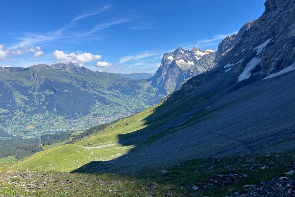
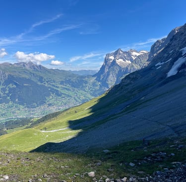
Looking down on Grindelwald from the Eiger Trail
Bonus
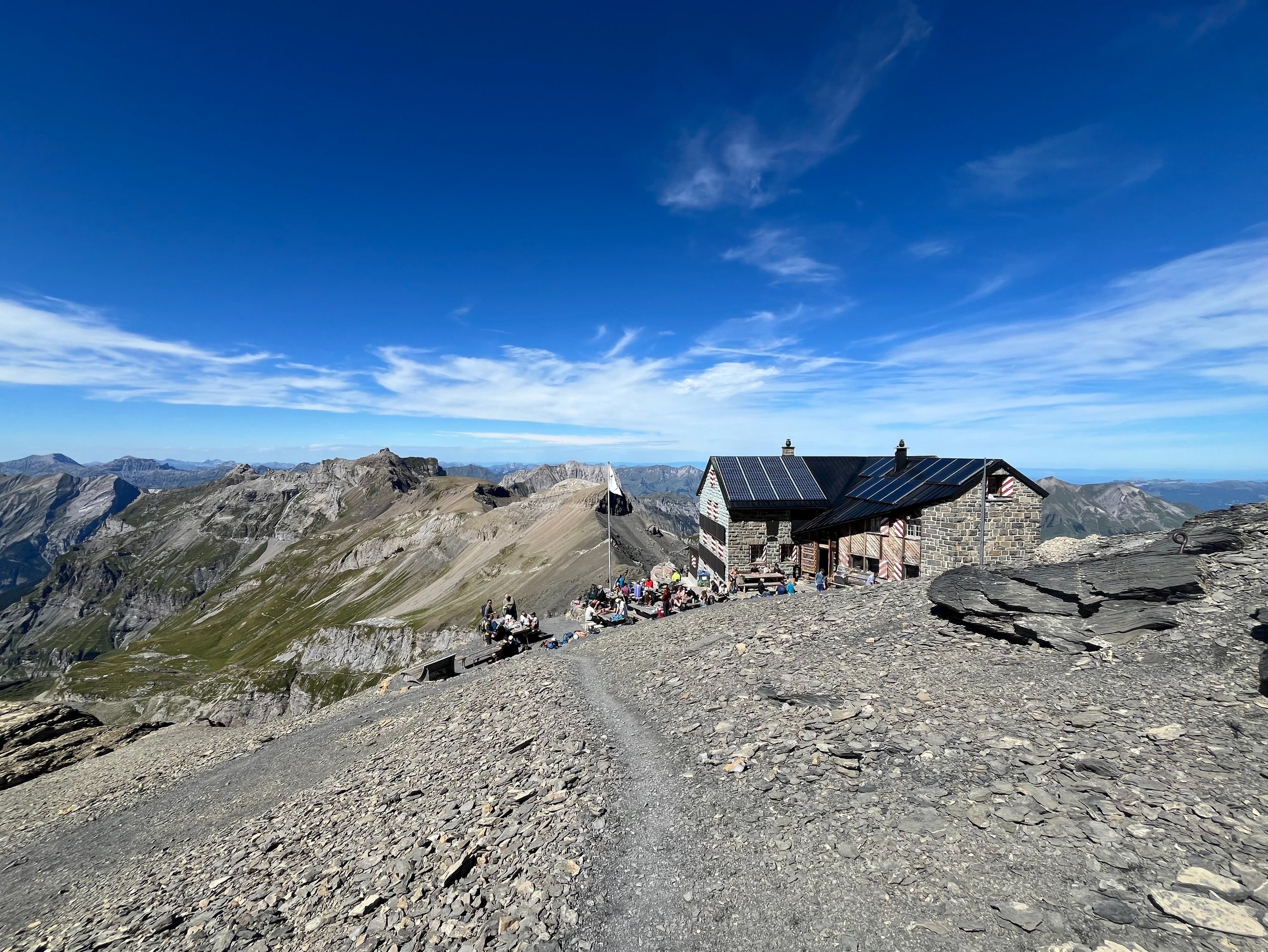
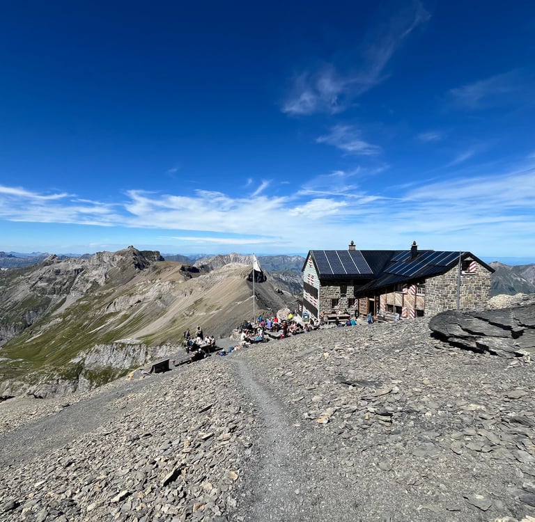
The excellent connections in the Jungfrau Region and the high density of trails make it possible to plan excellent longer day hikes or even multi-day treks. Männlichen to Alpiglen by way of the Panorama and Eiger trails or Lauterbrunnen to Eiger Gletcher by way of the famous Jungfrau Ultra Marathon route are great options for a longer day. If you are looking for an excellent multi-day, consider the 33 km (21 mile) hike from Mürren to Kandersteg by way of the Blüemlisalphütte.
Much more can be found in our Into the Alps and Discovering Bern Series as well as on the SwissMobilityMap.
We hope you enjoyed hearing about our five favorite walks in the Jungfrau Region. If you did, check out the other posts in the Best of Hidden Switzerland Series and be sure to share it with your friends. Stay tuned for additional articles on our Swiss travels every other week!
Until next time, gute Reise, and feel free to leave a comment on one of our social media platforms!
Overlooking Blüemlisalphütte