An Adventurous Walk Along the Shores of Lake Brienz, Just Minutes from Interlaken
A few weeks ago we walked along the northern shores of Lake Brienz and this week we are back, this time on the southern shore with a stunning and adventurous walk from Iseltwald to Interlaken. There's a lovely boat ride, a peaceful and quiet walk through forests and meadows, and more amazing views than you can shake a stick at!
DISCOVERING BERN
ISELTWALD TO INTERLAKEN
A few weeks back we posted about our walk from Interlaken Ost to Ringgenberg along the turquoise blue waters of Lake Brienz. That excellent and easy trip hits two interesting ruins as it meanders its way along the northern shores of Lake Brienz and, the best part is, it's super easy to get to from Interlaken.
In this week's installment, we are back at Lake Brienz to tackle the twin to the Ringgenberg walk, directly across the lake on its southern shores. This walk from Iseltwald to Interlaken is just as accessible as the walk to Ringgenberg and offers a whole different, and more adventurous, perspective on Lake Brienz.
While most of our Sunday walk/runs tend to be relatively tame affairs, this path was, honestly, a bit more than we bargained for. The elevation gains are not insignificant, the trail is rough in places, and there are some steep drop-offs, but the walk is gorgeous and well worth considering if you are looking for something a bit more challenging close to Interlaken.
The added benefit of this walk? We barely saw a soul the entire time and my bet is you won’t either. With that, we hope you enjoy this week back out on the shores of Lake Brienz!
You can follow along with our latest Lake Brienz trip using this interactive map
When we arrived in Interlaken a few weeks ago, we intended to walk from Interlaken Ost Train Station to Iseltwald and then catch the boat back. At the last minute, we decided to do the walk in reverse. We figured taking the boat out would be more flexible and less rushed. This redirection turned out to be a good move as our excessive picture-taking took a bit longer than anticipated.
While you can do this walk in either direction, I would recommend heading out to Iseltwald first like we did. It gives you more time to wander back at your own pace and enjoy the stellar views. You have the option of a bus or boat to/from Iseltwald and 10 out of 10 times, I would say, go for the boat.
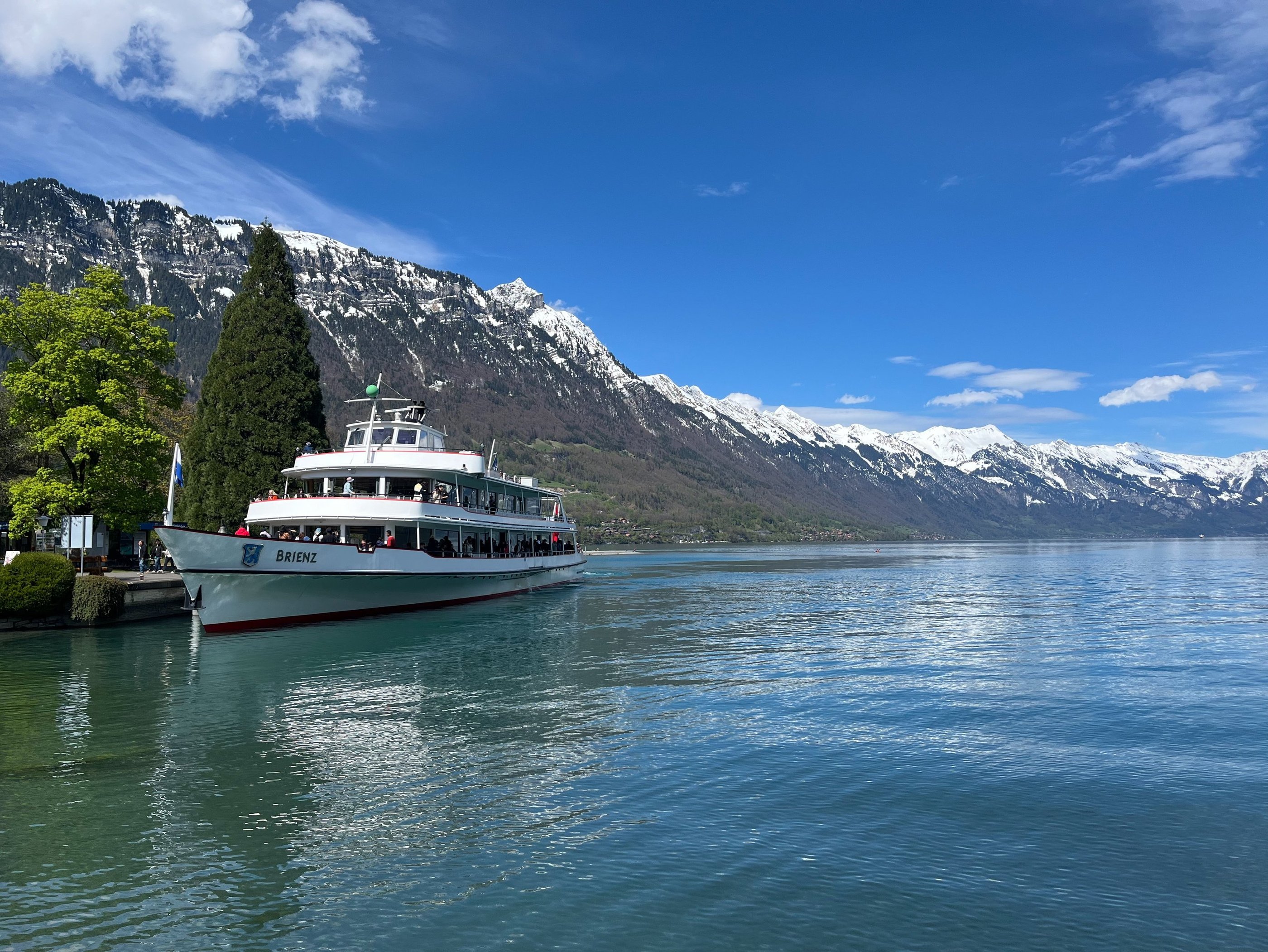
Plying the Waters of Lake Brienz
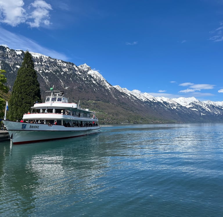
MV Brienz leaving Bönigen on its way back to Interlaken Ost
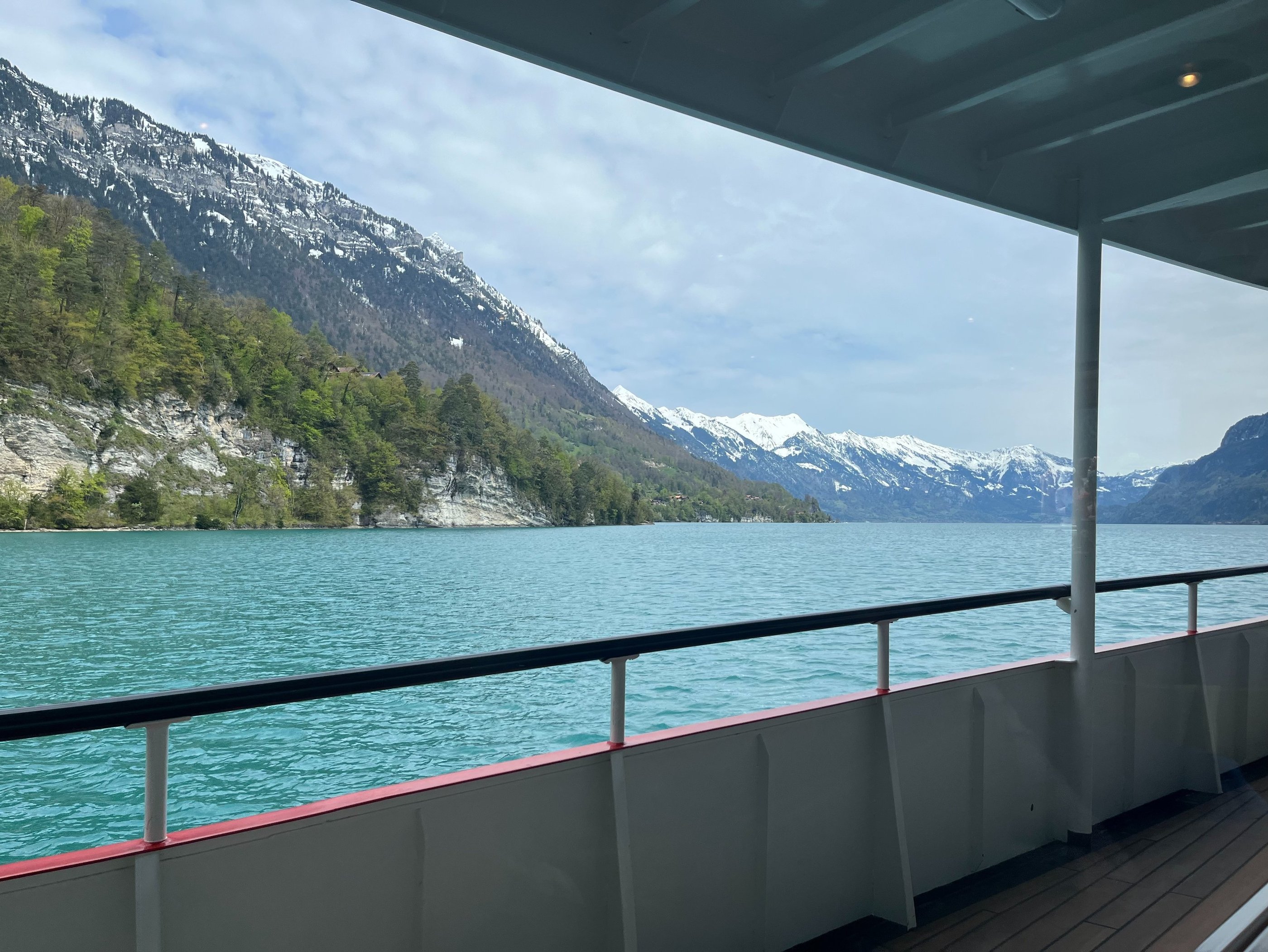
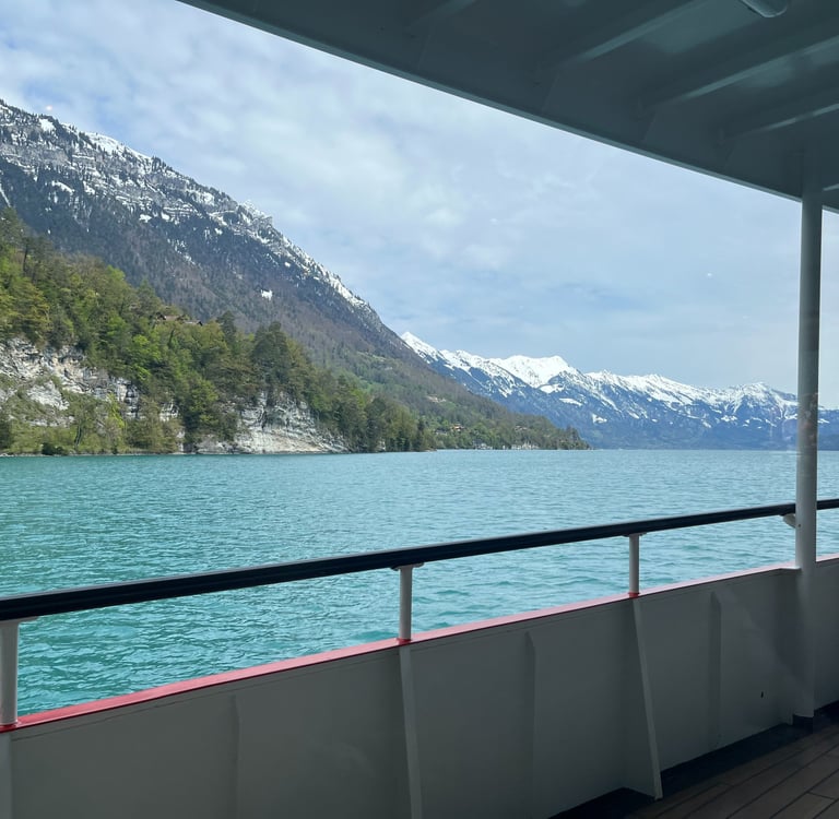
Views from the water on the boat ride from Interlaken Ost to Iseltwald
If you have the choice in the summer, shoot for Lötschberg and soak in the true Victorian experience. Unfortunately, for us, the paddle wheelers don’t run in spring.
Regardless of the boat, rest assured that the views from the turquoise blue waters of Lake Brienz are magical on this 45-minute journey to Iseltwald.
While I anticipated lovely views, I wasn’t expecting the quality of the international people watching, a sure sign that summer is close at hand in the Berner Oberland.
If you followed along with our trip to the Whitehorse races in St. Moritz earlier this year, you already know that people-watching is one of our guilty pleasures. When we did this walk a few weeks ago, the boat was crowded with selfie stick-waving sightseers jostling on the outside decks to catch their best angle.
I certainly can’t judge too hard. Ever since I started writing this blog, my time behind the lens has increased exponentially, but I am fairly certain a dragon could have exploded out of the lake and most of these people would never have noticed until they went to post their duck face Instasnaps to the internet.
If you have a Swiss Travel Pass or a GA, the boats are included, and the chaos can be more or less avoided by taking a coffee in the boat’s restaurant. The views are still exceptional, and, in my opinion, the environment is far more pleasant. If you want a bit more peace overall, just head out on one of the early sailings or (god-forbid) pay for first-class and drink in the lap of luxury on the upper decks.
I talked ad infinitum about the boats on Lake Thun and Brienz during our walks from Interlaken West to Neuhaus and Spiez to Thun a few weeks back. I won't jump back into that history too much here other than to say that, the boats on Lakes Thun and Brienz have fantastic stories and are an absolute joy to ride.
To me, nothing speaks better to the Berner Oberland’s Victorian character than sipping a drink in the boat’s restaurant while the views slowly drift by.
On our latest trip we took the Motor Vessel Brienz, certainly no Blümlisalp or Lötschberg (the two historic paddle-wheelers on Lake Thun and Brienz respectively), but its oak wood decks and nice furnishings offer a warm and comfortable journey with a bit of a rustic feel.
A Brief Visit to the Village of Iseltwald
I had heard the stories about how the small village of Iseltwald tucked along the shores of Lake Brienz went from relatively unknown to completely overrun almost overnight but I never really appreciated the magnitude of the problem until we arrived off the boat.
Iseltwald, a tiny and fairly standard collection of Swiss homes on a small peninsula extending out into Lake Brienz featured prominently in a popular 2019 Korean Netflix series called ‘Crash Landing on You.' While the views from the village are incredibly nice, the town itself and its architecture could be anywhere in the Berner Oberland. Despite that, when we visited, Iseltwald was completely and entirely overrun.
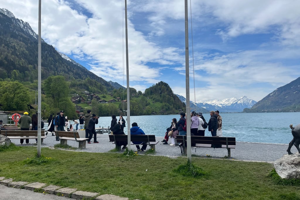
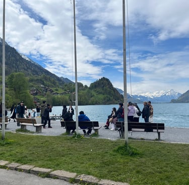
A small snippet of the international crowds at the boat station in Iseltwald
There are not even close to enough services (or even enough space) in this tiny hamlet to handle the crowds and a brief wander was enough for me to feel the plight of the residents... Every pier, garden, and house in town has become an Instagram backdrop. Mind you, this was in April, the shoulder season in the Berner Oberland, and matters are only likely to get worse as the summer season takes hold.
I am not sure there is a great solution for Iseltwald but I think the best is to try not to be part of the problem. Use the bathroom on the boat before you get there and try not to linger too long in front of people's houses.
Check out tiny Iseltwald if you would like but, in my opinion, you are better off heading straight for the start of the walk just next to the harbor. Within minutes of leaving the boat station, you can have the path (and the equally, if not better views) all to yourself.
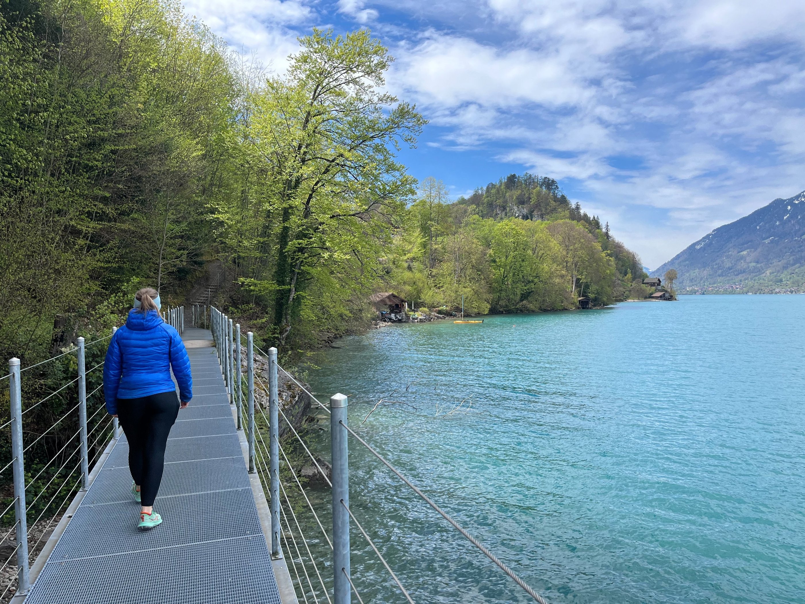
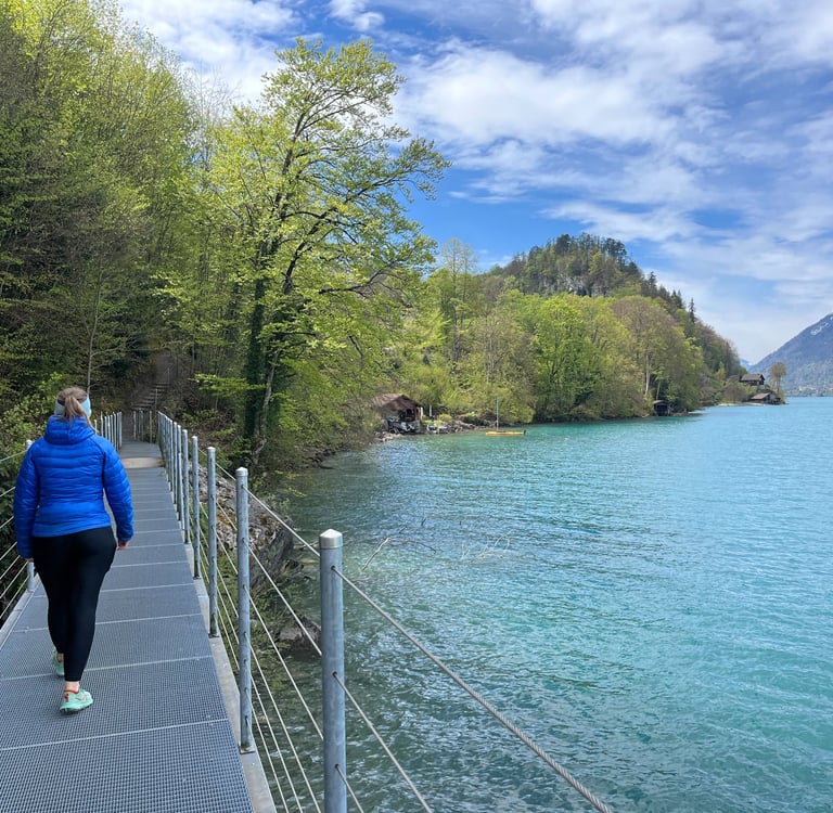
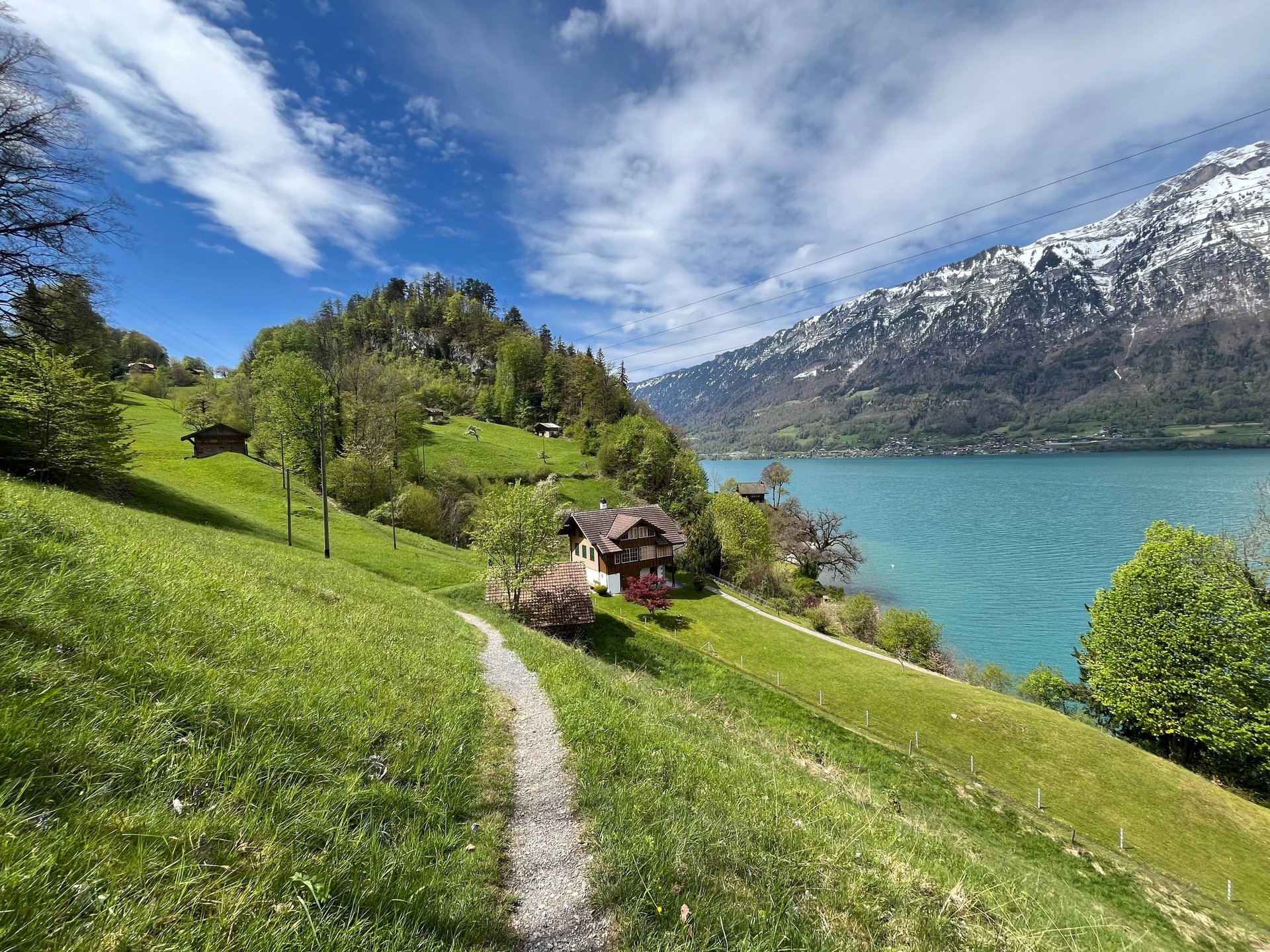
The exceptionally peaceful and quiet views just minutes beyond Iseltwald
Into Greener Pastures

Lovely views of the meadows just outside of Sengg
Like miraculous conception, you pass around the corner of the bay and, poof, the people, the selfie sticks, and the tripods are gone. It's completely quiet. Follow the path past a few houses and you feel like you could have been transported into another century before tourism.
The start of the path is pretty tame, crossing some boardwalks along the water before rolling up and down the banks of the lake through lush forest. Eventually you hit a few steeper spots before the path opens up into pastureland below Senggflue, a large rock outcropping.
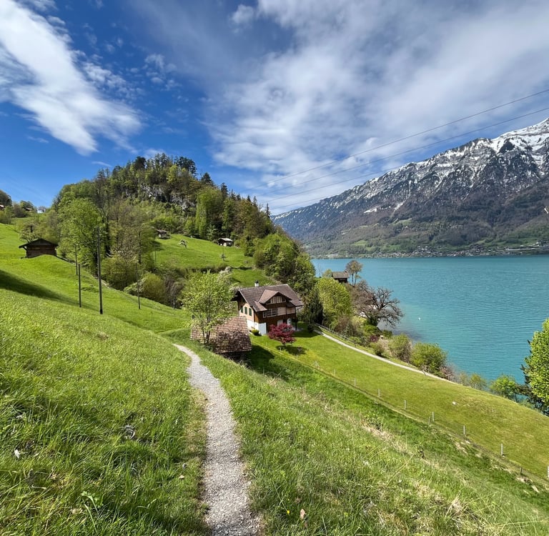
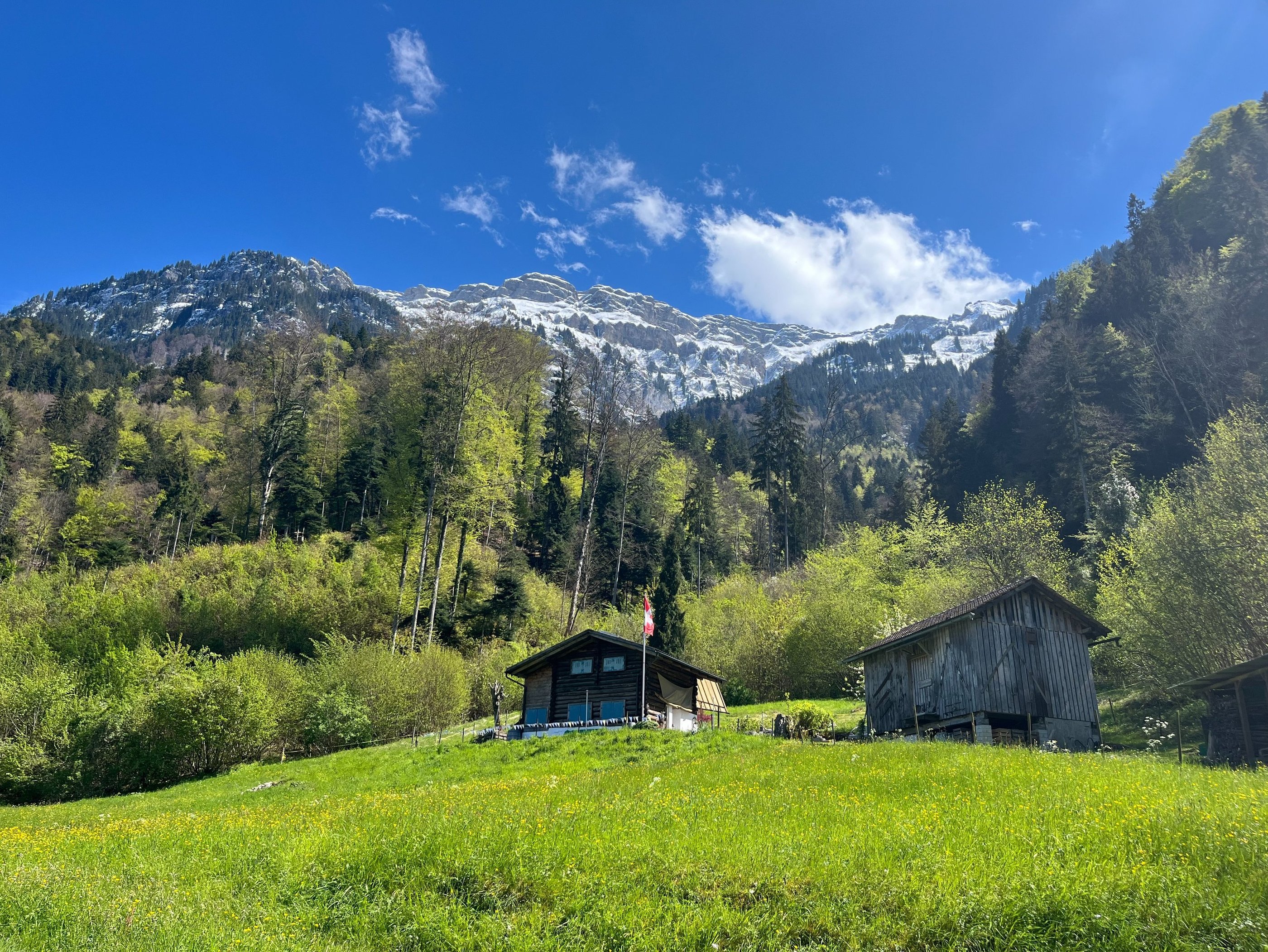
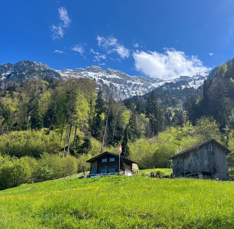
From here, you follow a large steeply sloping meadow up towards Sengg, a collection of lovely old chalets.
On your way up the hill, it’s worth taking a pause (if only to catch your breath on the not-terribly steep, but quite steady, incline). You can breathe in the fresh mountain air and listen to the babbling brook passing near the trail. Between this and the world-class views of Iseltwald and Lake Brienz right behind you, it is a fantastic spot.
Sengg has a lovely and well-marked little self-service market stand (quite common in rural Switzerland) selling all manner of local cheeses, homemade preserves, and other sweet snacks.
Once you have perused the selection, the main trail heads off to the left up the road but a nice sidetrack points you through the houses into the forest towards a quiet lookout point with a picnic spot on top of Senngflue. A great place to enjoy the cheese and crackers you just picked up!
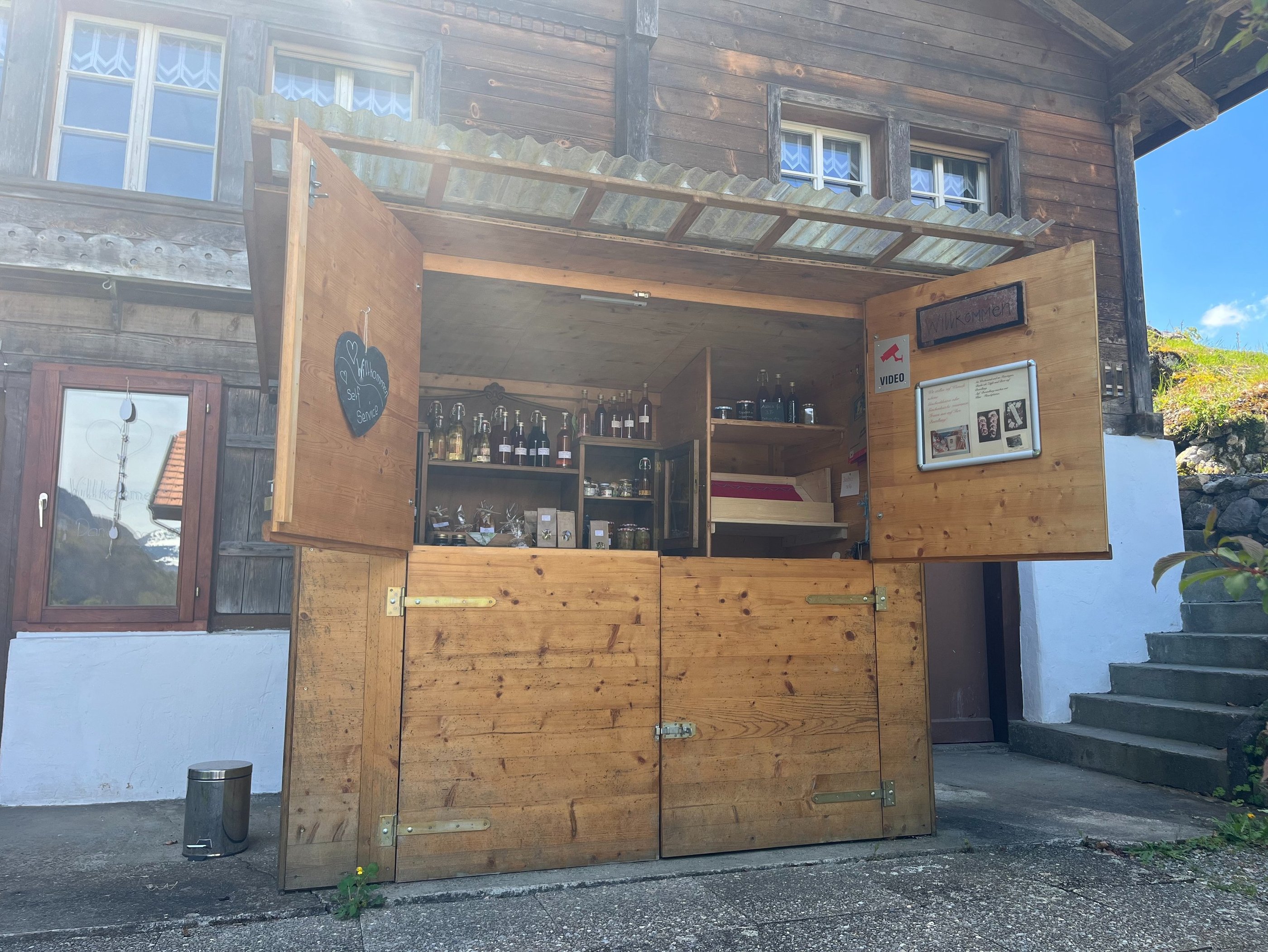
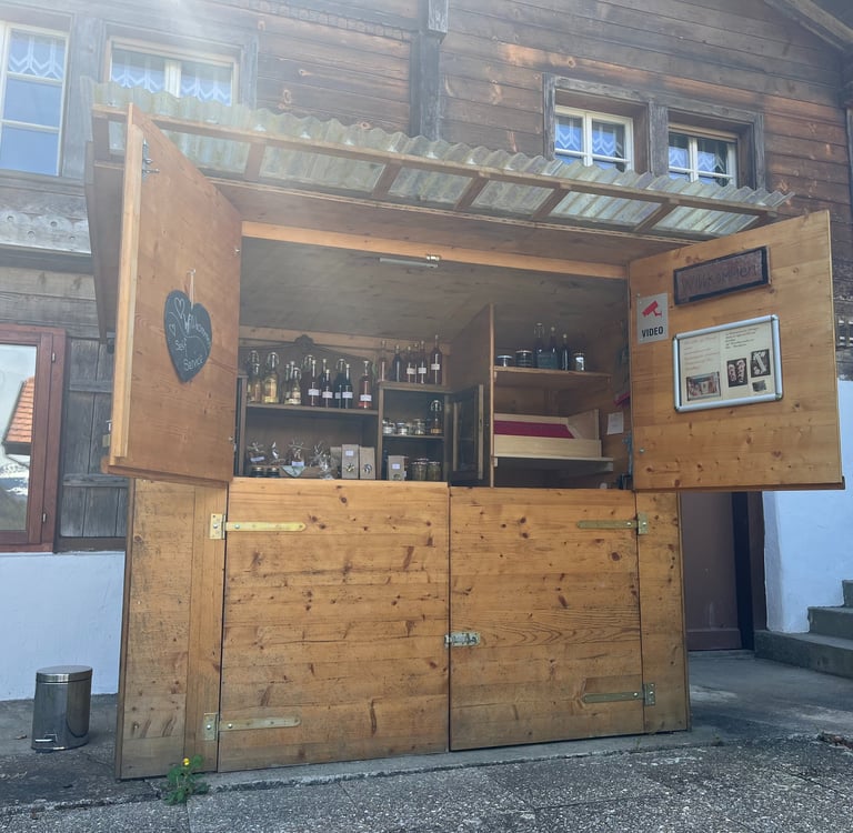
The Sengg Self-Service Market stall serving all manner of tasty delights
The Rougher Side of Lake Brienz
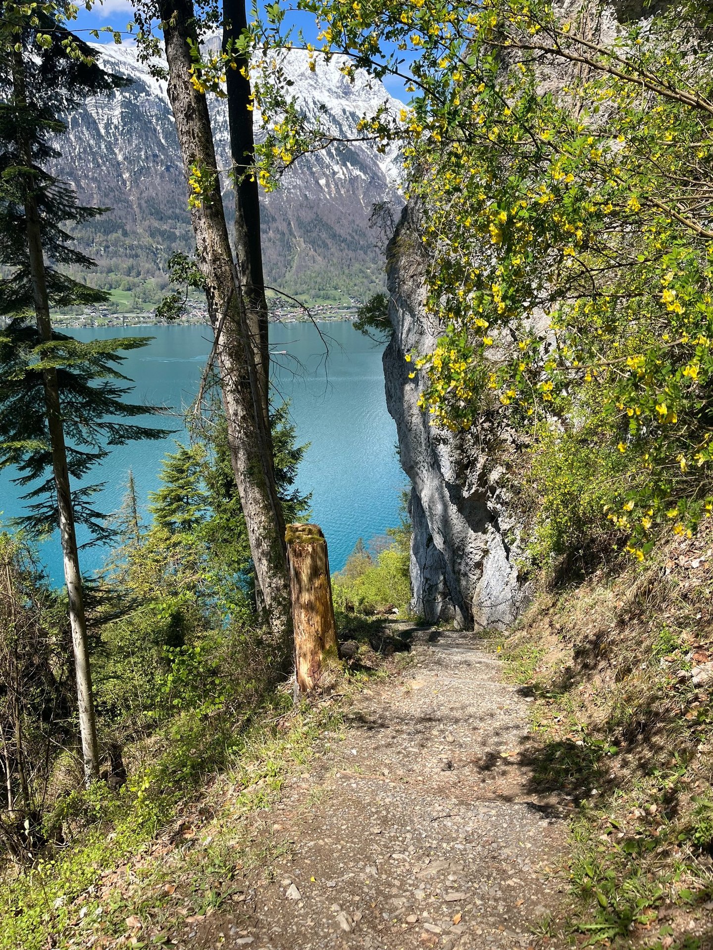
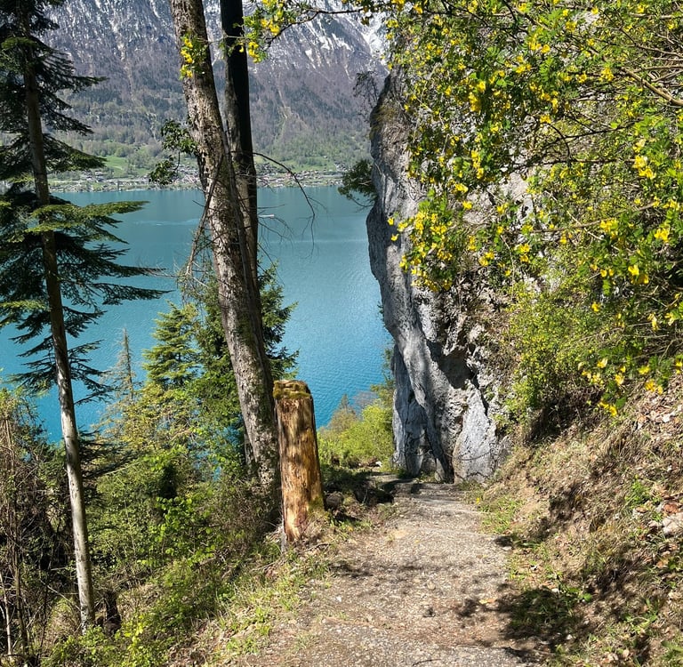
Once you have taken in the views and worked your way back through Sengg, the more adventurous portions of the path really begin. The trail rises steadily through pastureland and eventually into the forest on fairly well-groomed paths and roads. Eventually, however, the edge of Lake Brienz gets a bit too close to the surrounding mountains and the wide path narrows into a single-track trail.
As the situation got a bit more dire around Wysseflue, the trail builders were faced with the same dilemma as the highway builders at the lake edge down below, go far out of their way to stay on a gentle grade or take the trail around some precipitous drops, up some steep grades with chains to haul yourself up, then back down steep switchbacks. No surprise, the trail builders choose the later while the highway builders opted for a series of viaducts and tunnels, a much more costly affair which opened in 1988.
As long as you are in good shape, there is really nothing to fear here except getting a bit sweaty from the elevation gain. It is certainly a change in pace, however, from the more mellow walk on either end of the path.
Once you get through the single-track section, you end up on an incredibly well-maintained forest road that dead-ends just behind you. I am not sure of the story on this road, but it really goes to seemingly nowhere. It feels a bit too dramatic to be a logging road with modern engineering and concrete retaining walls on the upslope but perhaps it was just an abandoned project to connect through the section we just navigated or to gain access to the myriad of rockfall protection for the highway below.
Past the single track, the path generally follows dirt and paved roads all the way into Bönigen. Along the way, you have some excellent vistas of the mountains high above and cross bridges over several debris flow chutes and small streams making their way down to the lake below.
Views from the path around Wyssflue that don't do justice to how steep the trail really is
Views into the mountains from the path between Sengg and Bönigen
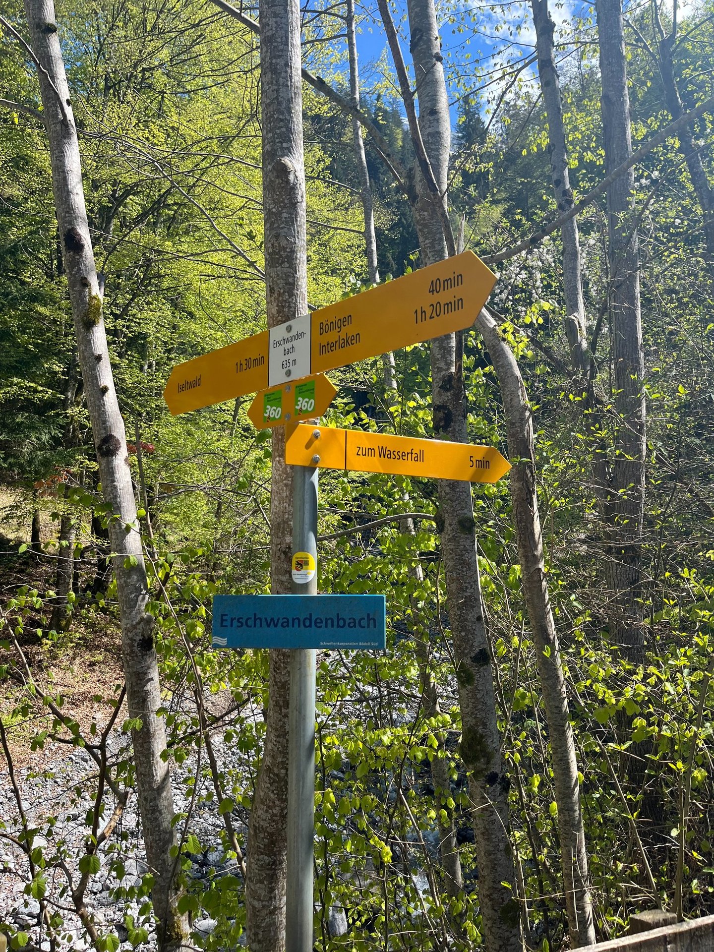
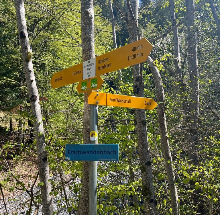
One of these streams, Erschwandenbach, has a short 5-minute side path that brings you to a spectacularly beautiful waterfall carving its way through the rock. This short detour is a must-do. When I got to the waterfall, there was not a soul in sight and the experience was truly excellent.
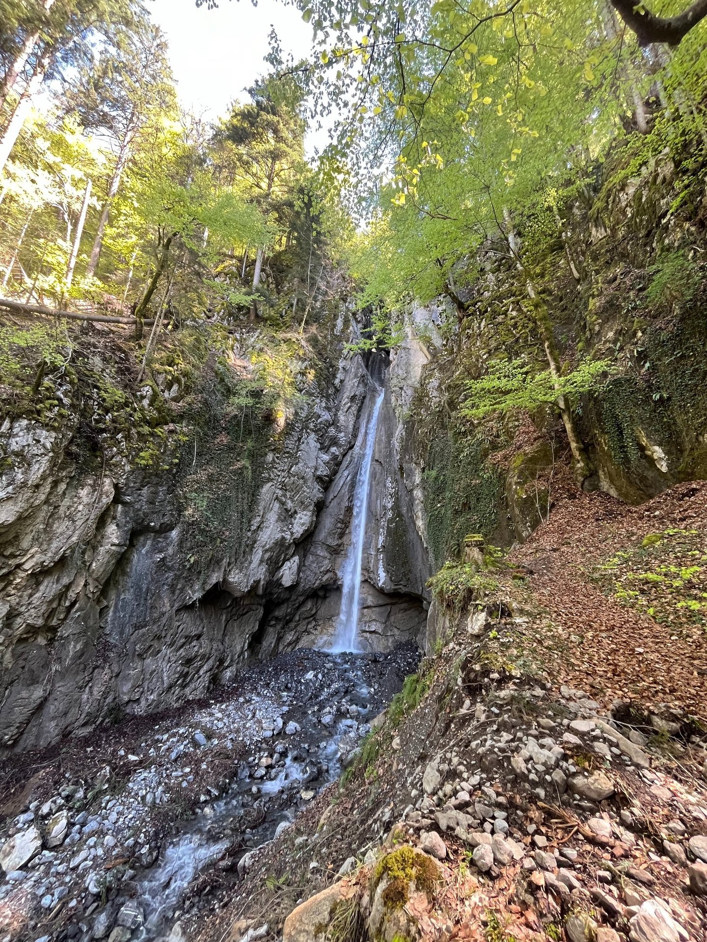
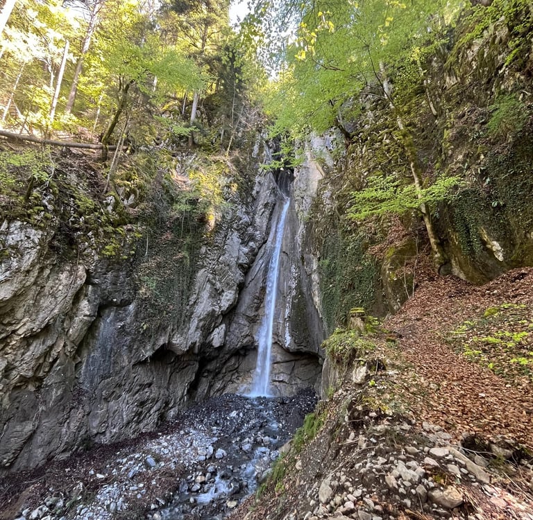
Erschwandenbachfall, a small detour on your way to Bönigen
Decending into Bönigen and Interlaken
Despite a couple of confusing intersections, almost all paths lead towards Bönigen at the head of Lake Brienz. Just follow the signs for the Panoramaweg and you will be sorted.
If you read about our walk from Interlaken West to Weissenau a few weeks back, we mentioned the Bödeli railway which built to connect Därligen on Lake Thun to Interlaken in the late 1800’s. After Interlaken West, this same railway passed through the location of today’s Interlaken Ost train station and terminated right here in Bönigen allowing for ships on Lake Brienz to forward cargo further into the Alps.
Since 1969, the rail line has retreated back to Interlaken Ost with its direct connections to Luzern over Brünig Pass and the Jungfrau Region. In the post-rail era, the small town of Bönigen has gotten a bit quieter but has retained its charm.
There is a lovely little bay where you can grab an end-of-walk gelato and a boat dock where you can catch the boat back to Interlaken Ost if you are tired of walking. Plentiful benches allow you to soak in the gorgeous views looking up Lake Brienz towards Ringgenberg Castle and beyond.
If you choose to walk back to Interlaken Ost station as we did, the path from Bönigen along the lake and Aare River is relaxed and flat as a pancake.
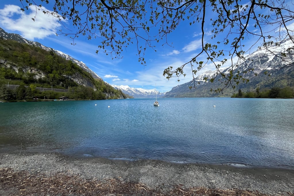
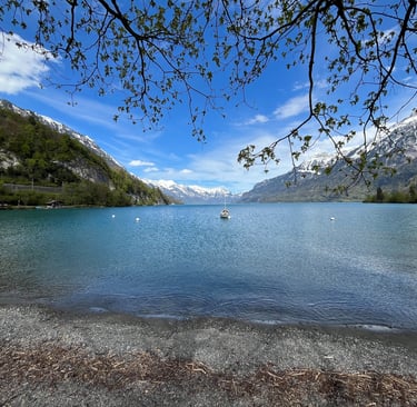
Gorgeous views up Lake Brienz from Bönigen
Is this Really a Walking Path?
Honestly, if we had planned on going on a hike, we wouldn’t have blinked an eye at the more adventurous parts of this 11 km (7-mile) walk. All of this would be par for the course on a proper hike here in Switzerland.
Nearly all of Switzerland’s trails are marked and graded yellow, red, or blue. This grading system features on topographic maps (like the Swiss Mobility Map we have mentioned before), on signposts in towns and at intersections, and in the ubiquitous and generally well-placed trail markers you see along almost every path.
An example of a Swiss Trail Sign near Erschwandenbachfall
Yellow routes (what this path is marked as) tend to be fairly mellow with little elevation change on generally well-maintained tracks or roads. Almost every walk we have shared with you to date on Hidden Switzerland Travel has been graded as a yellow. Red routes are trails that step up the game a bit. More often than not, these paths are single-track trails which gain significant elevation, require a bit sturdier footwear, and tend to have a bit more exposure. Finally, blue paths are alpine routes. At some point during a blue, you are likely to be extremely exposed and in a lot of cases you may want a rope or more technical gear for comfort.
To borrow from climbing parlance, parts of this path from Iseltwald to Interlaken are completely sandbagged. In other words, parts of the path are graded lower than they should be. On its own, the single-track around Wysseflue with the chains and steep drops would almost certainly be considered a red. Given this is part of a Panoramaweg (officially Stage 1 of the Brienzersee Drei Wassserfälleweg - one of many particularly beautiful named paths in Switzerland) where most of the path is easy walking, I think the thought was to simply lump this section in as an easy walk.
As always, it pays to check the topographic maps of your route before you head out to make sure this is the right trip for you. The Swiss Mobility Map which you can download as an app to your phone, paper maps, and a myriad of other applications like All Trails or Gaia GPS should be able to help you here.
Realistically this trip only has a few kilometers of more challenging terrain to traverse but, if you are looking for a more pleasant stroll along the shores of Lake Brienz, look to Ringgenberg on the other side of the lake.
If you don’t mind a bit more adventure in your life, the southern side offers some excellent natural scenery and perhaps above all, solitude near busy Interlaken.
We hope you enjoyed this week’s installment of Discovering Bern. If you are looking for more adventure across Switzerland, you may enjoy our other ongoing series, One Year: 26 Cantons where we visit each of Switzerland’s 26 Cantons in 2024 or Into the Alps where we share the natural and human geography of the Swiss Alps.
Feel free to comment on our social media or reach out with your own experiences and suggestions. Until next time, gute Reise!