Paddling Past Switzerland’s Infamous Dragon Lair on Lake Thun
Lake Thun's south eastern shore is wonderfully wild and rugged. A full departure from the tame western shore. Join us this week as we paddle from Beatenbucht to Neuhaus exploring sea cave, dragon lairs and the mystical places of power on Lake Thun!
INTO THE ALPS
Beatenbucht to Neuhaus
You can follow along with our paddle using the interactive map above. Please ignore the elevation gain here. The Gaia GPS topo maps that define the profile are incorrect.. It is a lake... it is flat.
For months I have been envisioning a nice long paddle on Lake Thun but, despite living just minutes from the water, I still find it remarkably difficult to find the time. With ever changing weather, work, Canton visits, and tons of hiking to be done, there has hardly been a free second for a short swim let alone a paddle.
Just before the temperatures plummeted across Switzerland a few weeks ago though, I found myself alone at home with a free morning and absolutely pristine weather. The perfect opportunity to explore the eastern shores of Lake Thun and I jumped on it.
With a light wind at my back, my trusty packraft and I made our way from Beatenbucht, about halfway between Interlaken and Thun, up the lake to Neuhaus, the end of one of Interlaken’s best walking paths. While I have done this trip a number of times cruising on the Bel Epoch steamship Blümlisalp, slowing down, getting closer to the water, and right up against the shoreline offered a whole new perspective on Lake Thun’s rugged eastern shore.
Bobbing at the base of the massive cliffs where the lake shore road is forced into tunnels high above, you could almost be forgiven for thinking that you had been transported out of the heart of central Europe and straight into the Norwegian Fjords. The processes that shaped Lake Thun are really not so different and the views are downright spectacular.
This week, we take a dive into the geology, legend, and lore of Lake Thun. From the processes that formed the massive cliffs to the dragons that once called them home. It’s an excellent trip, minutes from Interlaken, that you simply won’t want to miss.
Thanks for joining!
Paddling Lake Thun
Most of the towns on the western shores of Lake Thun (think Gwatt, Spiez, Faulensee, etc.) are interconnected by both regular summer boat services and the Lake Thun Kanuweg, or Canoe Path. By virtue of those routes, there are convenient canoe, kayak, and stand-up paddle board rentals in most of the towns and it’s exceptionally easy to get on the water and head out at your own pace.
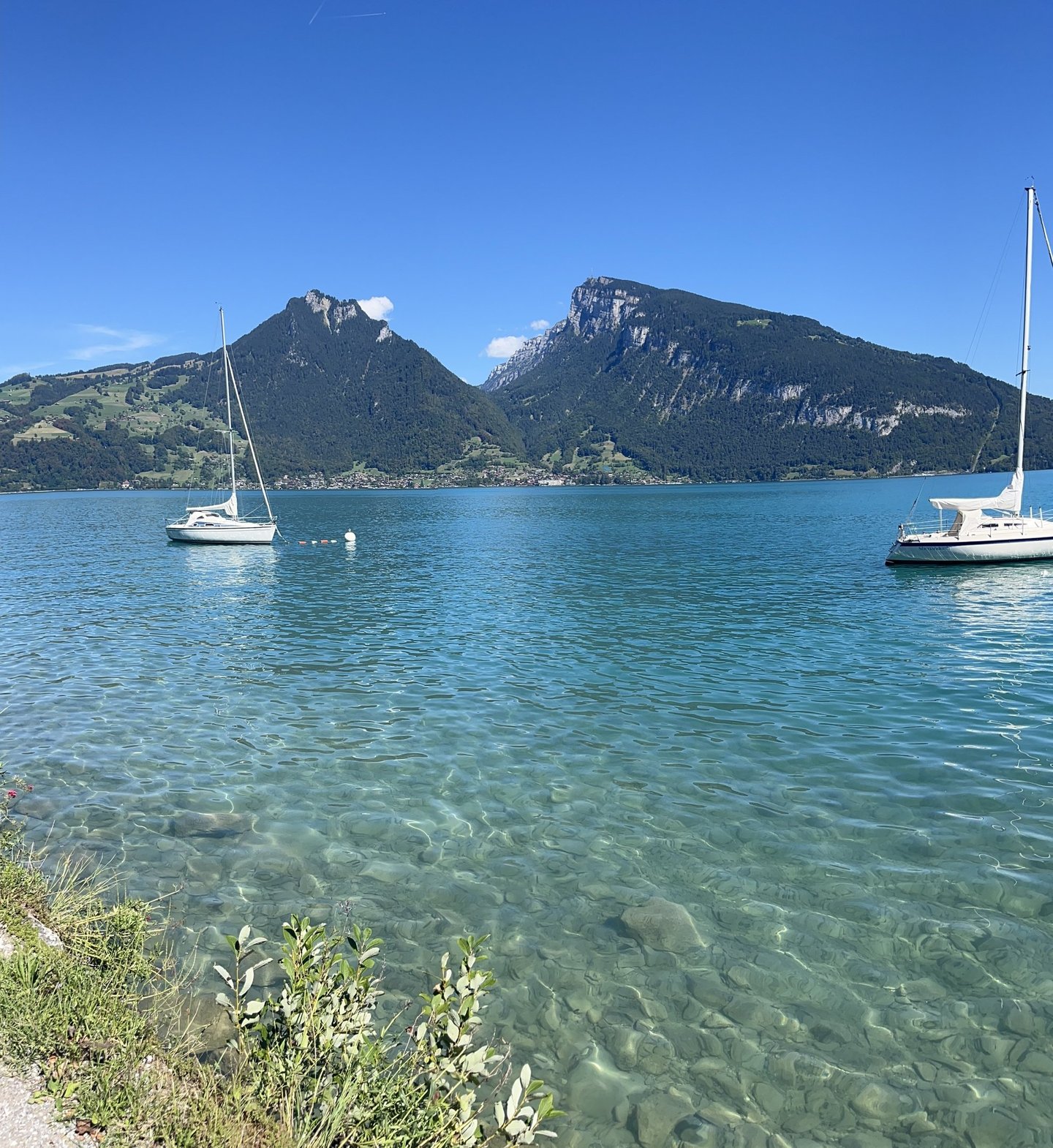
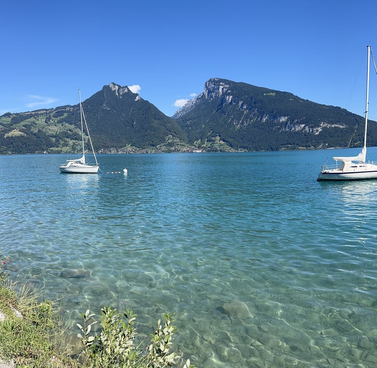
Unfortunately, except for a stretch of steep cliffs between Spiez and Einigen (10/10 recommended if you are looking for a nice paddle), the western shore of Lake Thun has pretty tame topography and, on a nice summer day, you will find yourself on the water with plenty of other boaters and paddlers. The views are wonderful from the water, but you never feel very far from civilization.
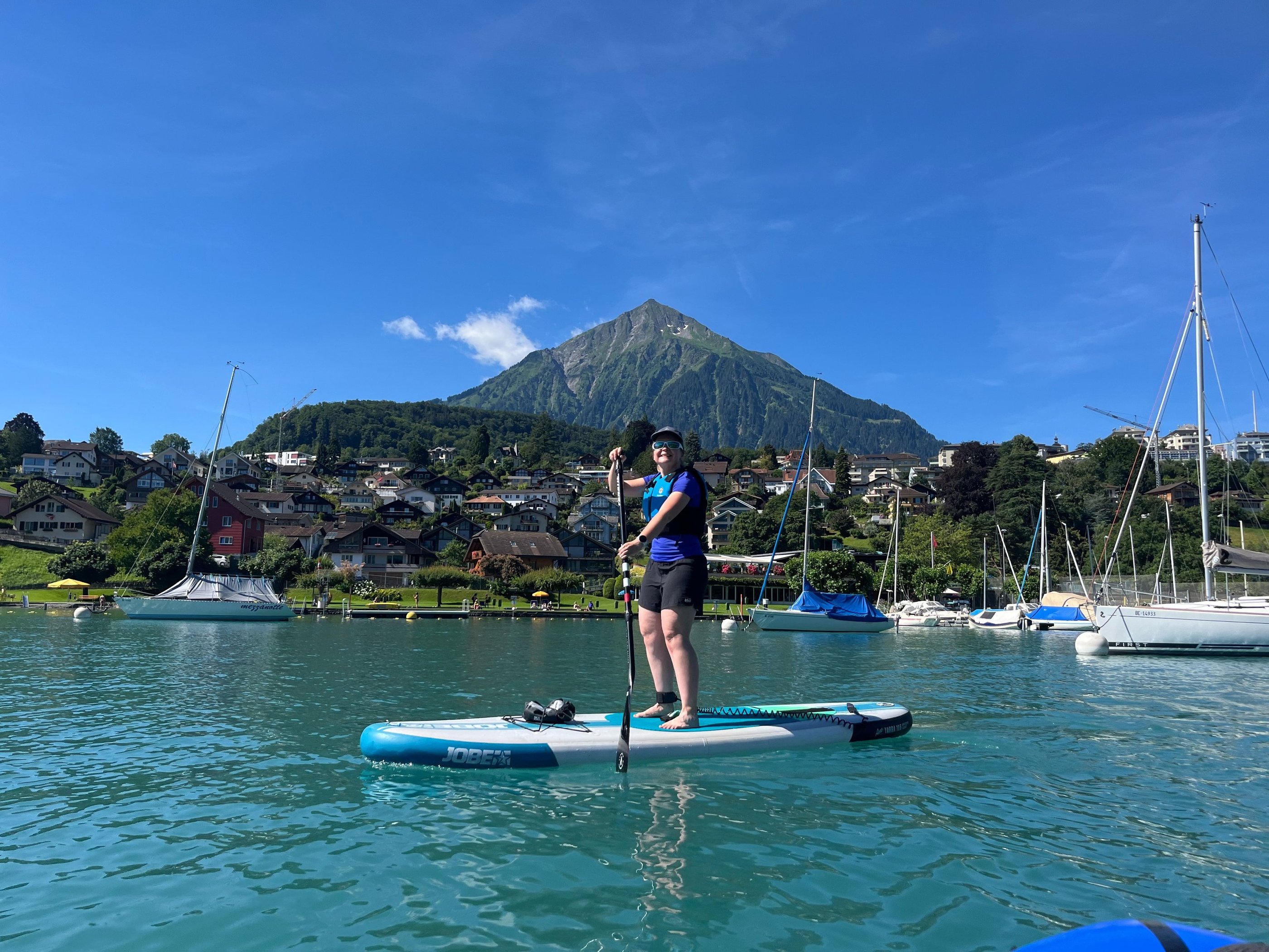
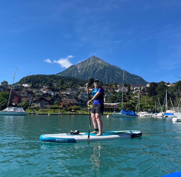
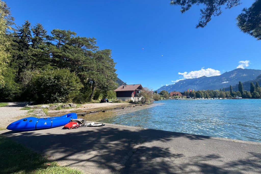
Corinne Paddling in Spiez on the Western Shore of Lake Thun
So enters my interest in paddling along Lake Thun’s eastern shore. In comparison to the mostly gentle topography on the western side of the lake, the southeastern shore of Lake Thun is downright wild. In many places, the cliffs jut straight out of the water and, where they don’t, the shoreline tends to be rocky, sparsely populated, and pretty difficult to access.
Of course, all that means, the eastern shore offers a bit less flexibility. Launching points are few and far between and there are not many rental options along this stretch of the shore. My paddle started just north of Beatenbucht and ended at Neuhaus but, if you don’t bring your own equipment, you will have to rent it in Neuhaus and do the paddle as an out and back from there (probably not covering quite as much water unless you are a strong paddler).
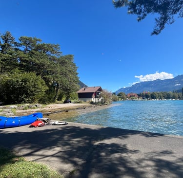
Arriving at Beatenbucht
My day started off with a boat ride to Beatenbucht from the far side of the lake offering exceptional views up the Justistal, the giant glacially carved ‘U-Shaped’ valley above the eastern side of Lake Thun. The Justistal is flanked on its northern side by Sigriswiler Rothorn and on its southern side by the more famous peak, Niederhorn.
In order, Sigriswiller Rothorn, Justistal, and Niederhorn. The Niederhornbahn forms the curving line on the far right side of the slope. Our paddle starts at the bottom.
A short walk from the dock at Beatenbucht brings you to the base of the Niederhornbahn, a funicular to Beatenberg, about 1/3 of the way up to Niederhorn. From there trails or a gondola take you the rest of the way up the mountain. The whole trip is exceptional and deserves its own guide at some point in the future but, for the purposes of our paddle, we head north from the dock to a small park about 200 meters (c. 650 ft) up the road.
Along much of the north-eastern side of Lake Thun, rip-rap and a steep shoreline protect the road and houses from wave action. In the park just up from Beatenbucht, there is a steep and narrow staircase that cuts down to the water primarily granting access for swimmers, but, if you are careful, you can also use it to launch your personal watercraft of choice. For me, that’s my Alpacka Packraft which has traveled the world with me over the last 5 years.
Originally built for mixed expeditions, packrafts are a packable flatbottom boat that break down into a backpack. My open boat weighs in at about 2.5 kg (about 5.5 lbs.) and inflates to about 2.3 meters long by 1 meter wide (92 x 37 inches) using a light-weight inflation bag. It’s a bit pricy but, if you are looking for something sturdy and ultra-portable, I can’t recommend them enough.
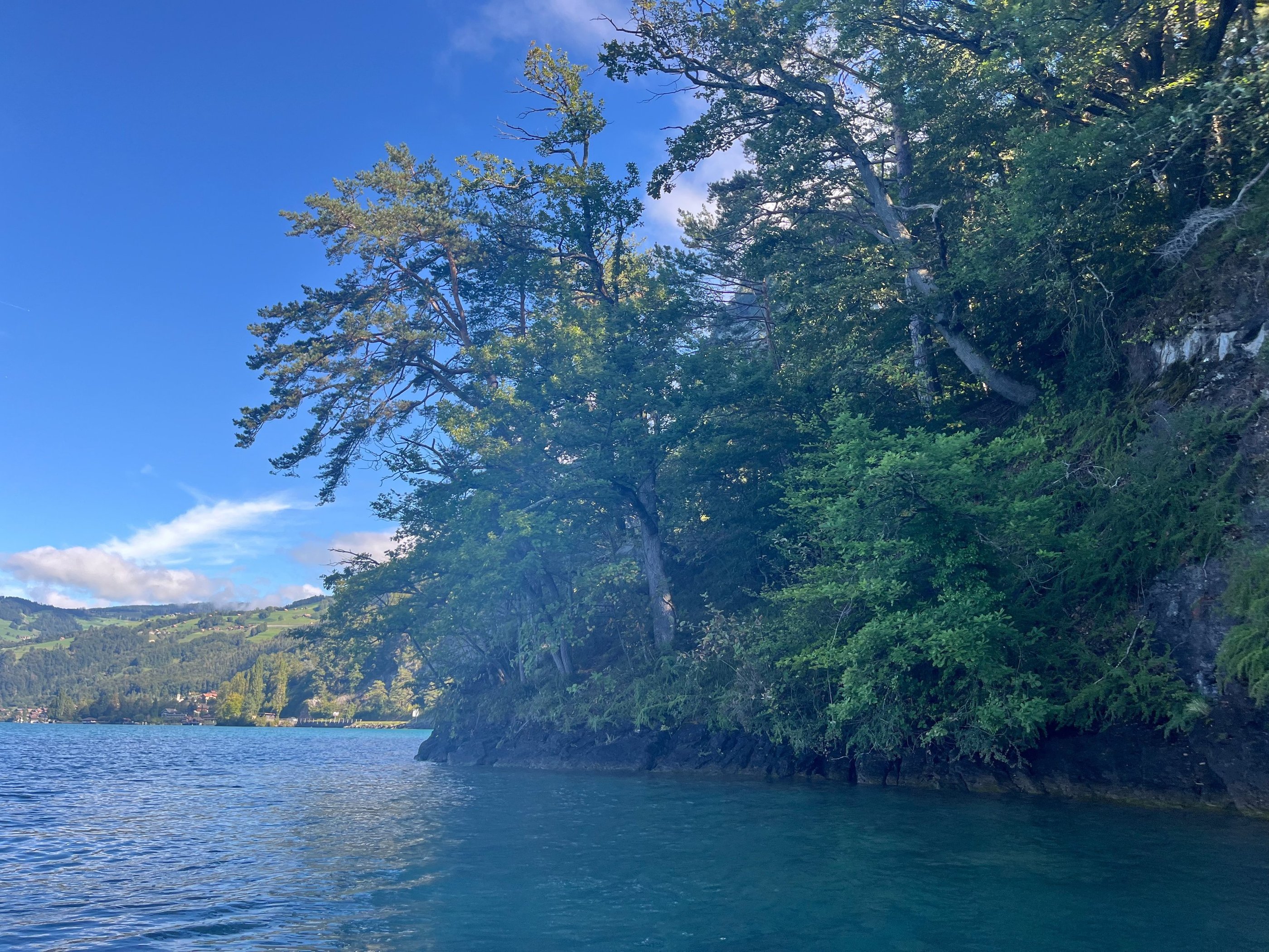
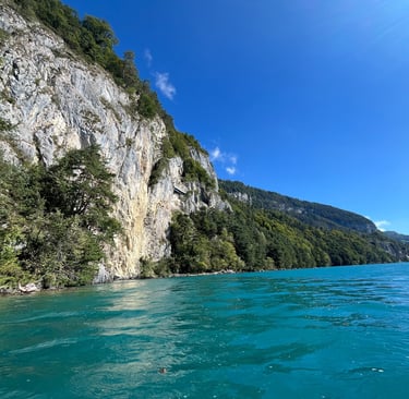
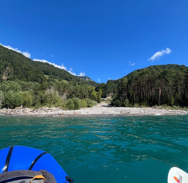
Finally out on the water, I paddled south along the shore past the Neiderhornbahn to the first wild section of shoreline between Beatenbucht and Balmholz, the Nastel Nature Reserve.
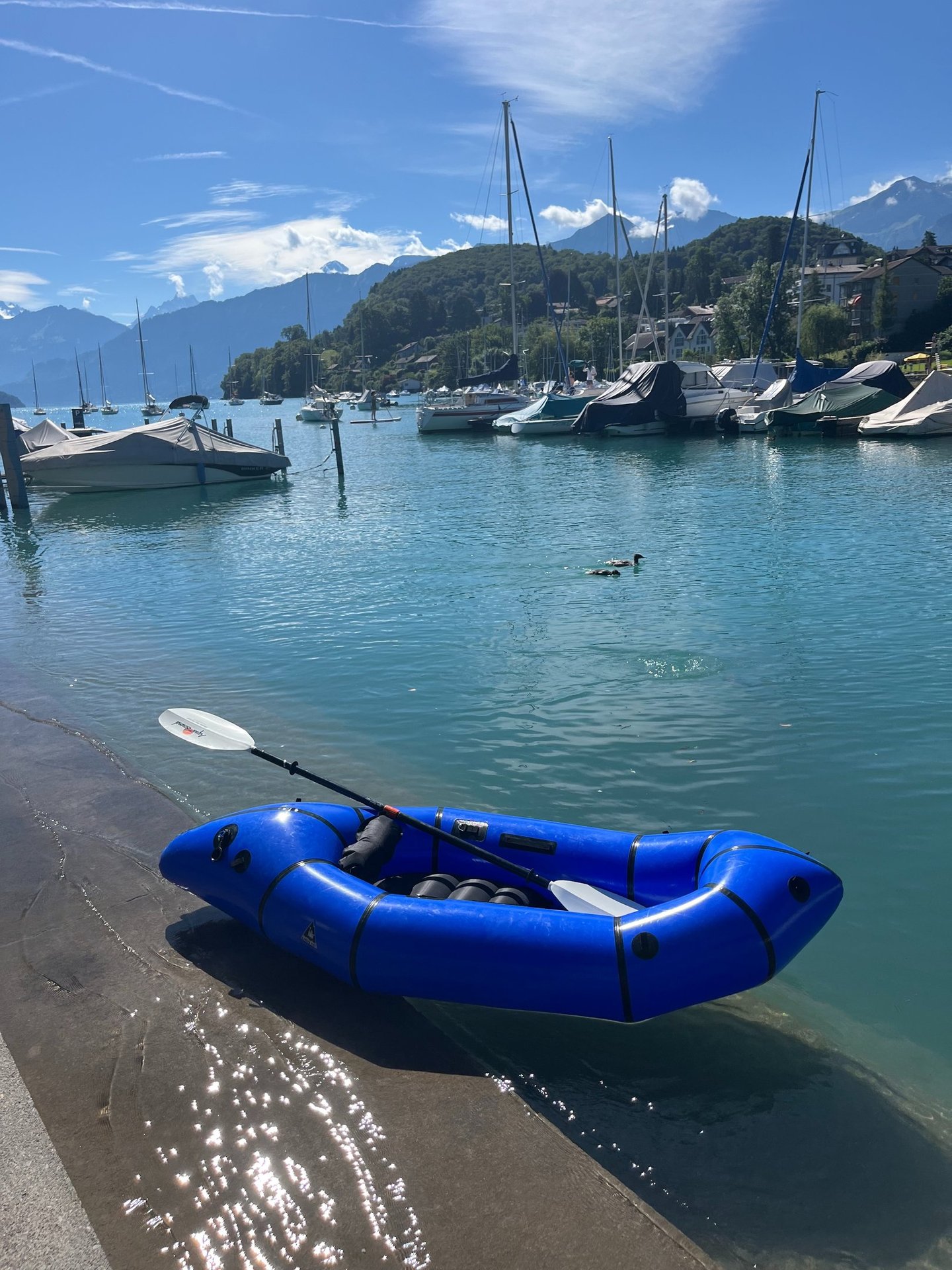
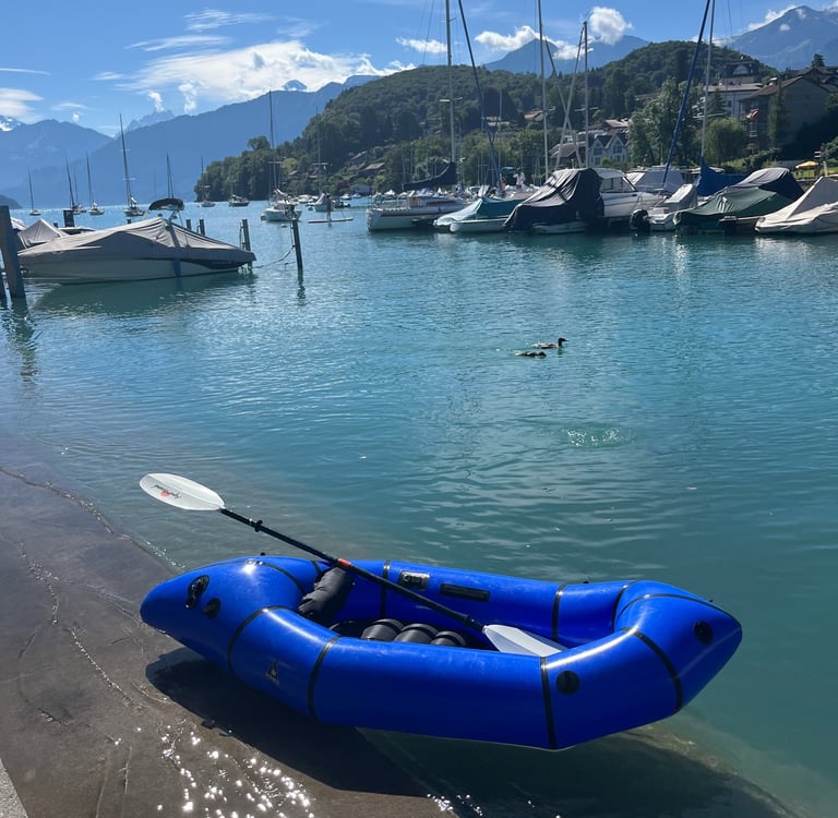
My watercraft of choice, the Alpacka Packraft
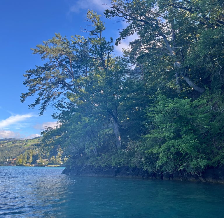
The Nastel Nature Reserve
Pine Forest to the Waters Edge
Past Beatenbucht, which translates to Beaten Bay, the rock juts out into the lake a bit and, with the exception of a couple isolated boat houses, the shoreline is steep and devoid of people. The beautiful forest, which covers most of Niederhorn extends down to the water’s edge lending some shade in the morning and providing a lovely back drop to start the paddle.
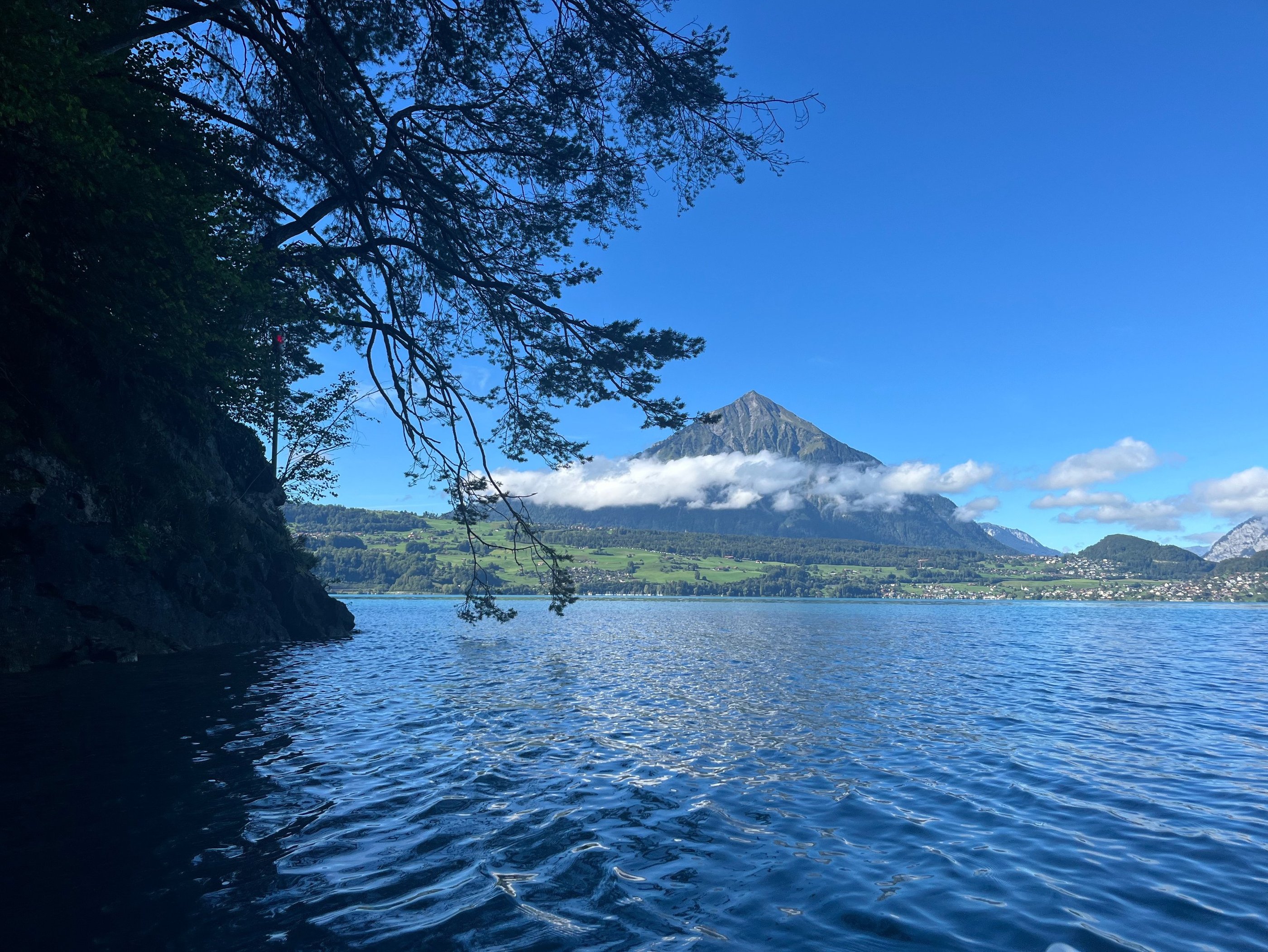
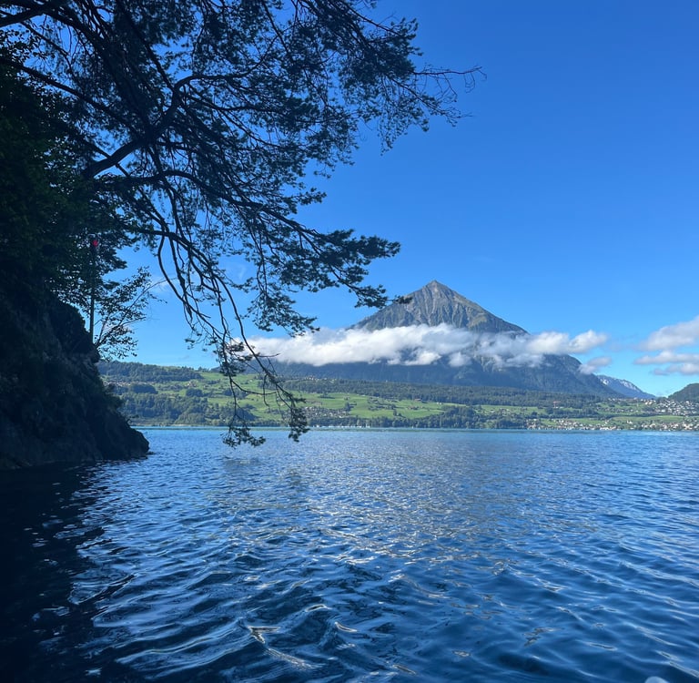
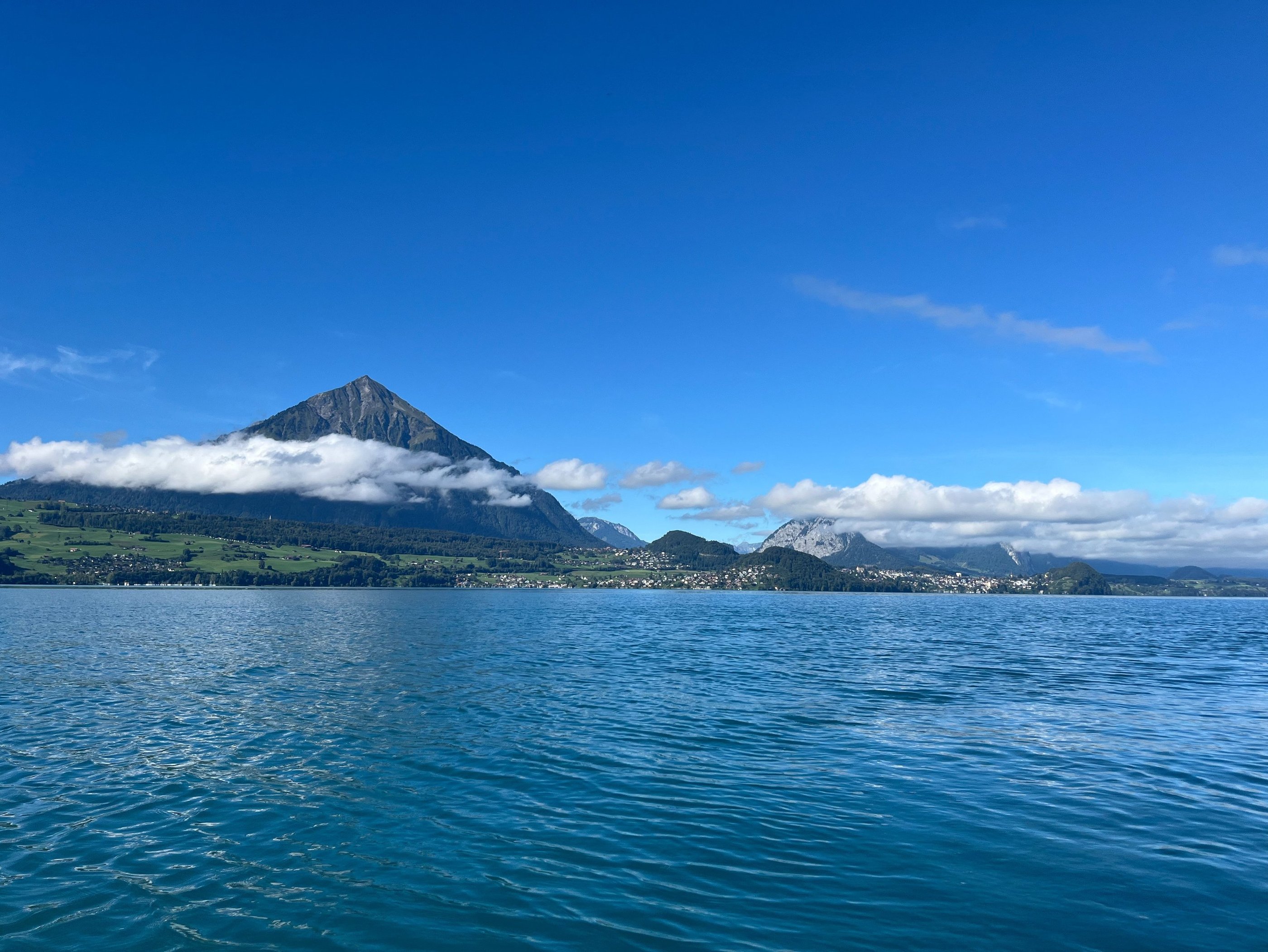
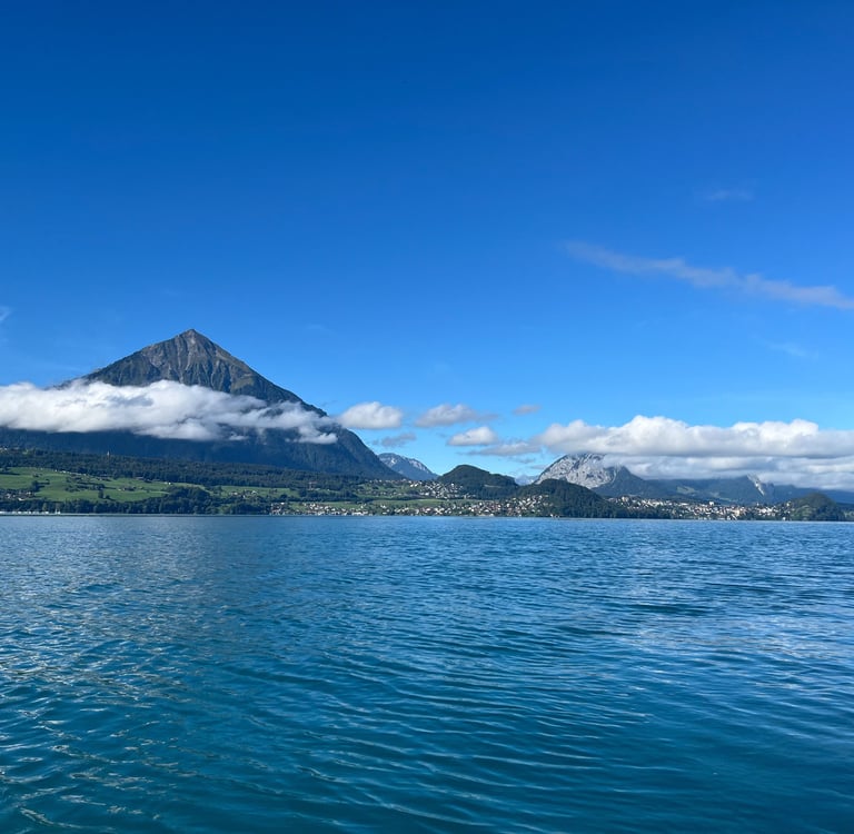
While the forest of the Nastel Reserve is nice to look at, the real drama takes place across the lake. Niesen, the Swiss Pyramid owing to its perfect triangular shape, dramatically towers over Spiez, Faulensee and Lake Thun. At certain times of the year, the afternoon sun is actually blocked by Niesen and a conical shadow is cast on the water, at times perfectly touching the far shore.
Niesen is perhaps the greatest exemplar of Mystische Kraftorte, or Mystical Places of Power, on Lake Thun. Now, before I dive in much further, let me preface by saying that I don’t generally ascribe much to the occult, but I can appreciate historical and religious significance.
There is ample archaeological evidence that, before the Romans, and eventually Christianity, swept across Switzerland, the native Celtic people were highly spiritual. Concentrations of religious burials and offerings have been found all around Lake Thun.
We also know that the Celtic people were incredibly connected to place and landscape. Some of the Kraftorte on Lake Thun were almost certainly spiritually significant and, in that view, I am perfectly fine ascribing power to them (not to mention most are just stunningly beautiful).
Looking up at Niesen from the Nastel Nature Reserve
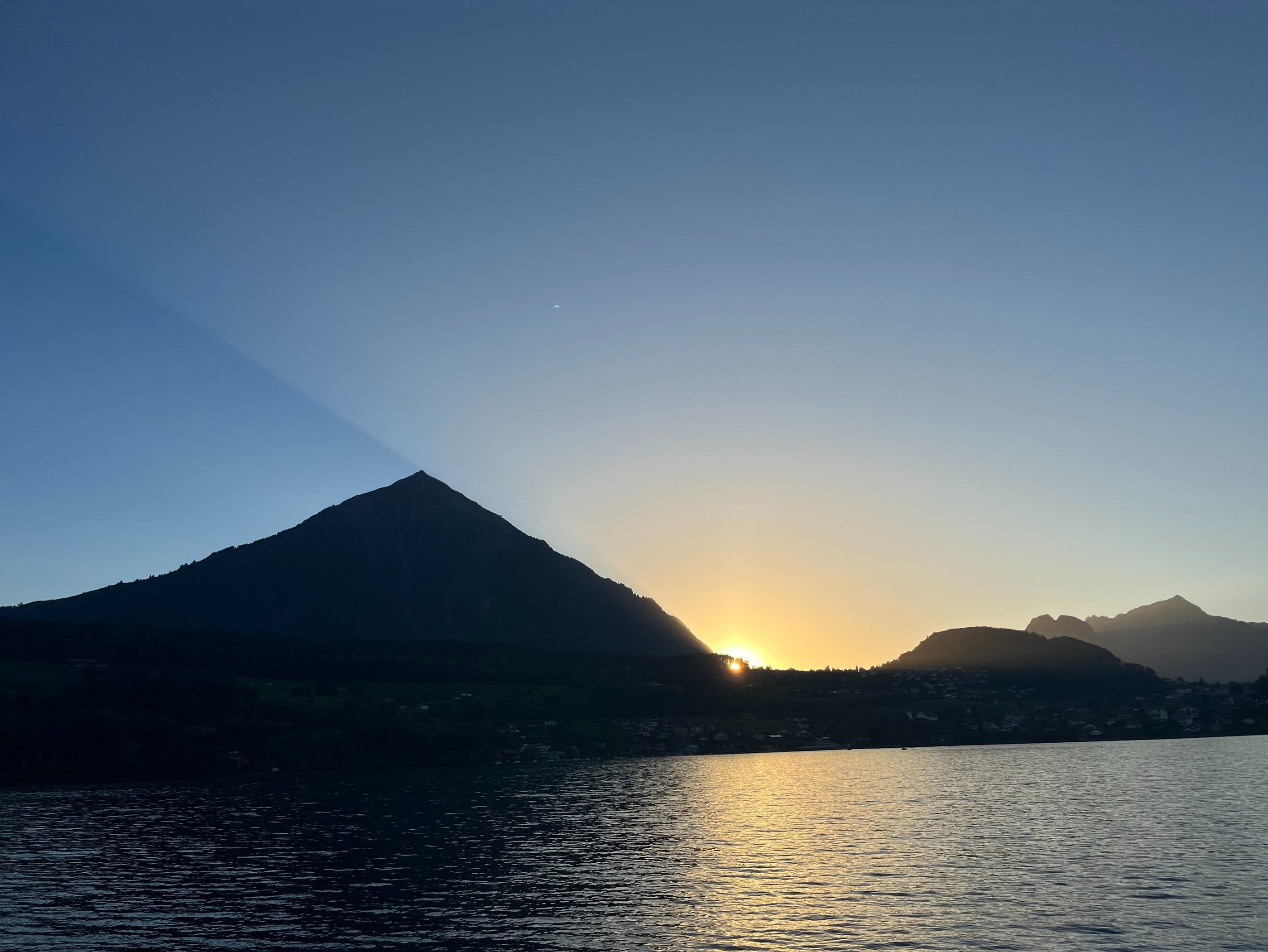
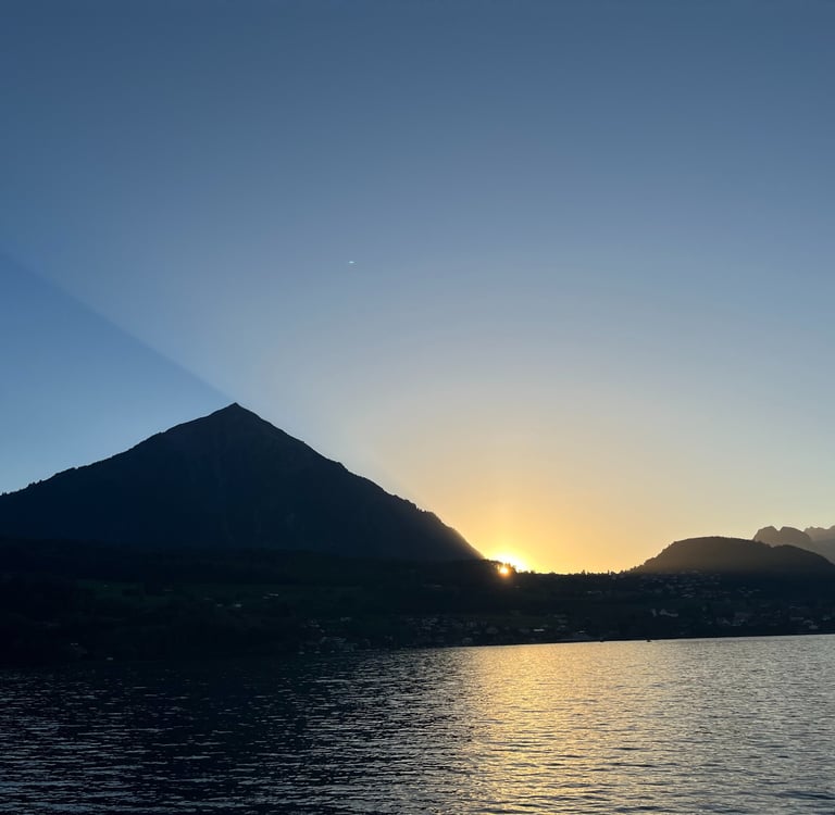
Niesen casting a shadow over Lake Thun at sunset
Between Niesen and the lake, are two sets of hills. The smaller set of hills close to the lake is called the Bürg. With its two adjacent peaks forming the bosoms between Spiez and Faulensee, the Bürg is naturally considered the ‘hill of mother earth’ offering its power accordingly. The further peak of the Bürg is the site of a known Celtic-era fortress though, to save you the trip, I can confirm that there isn’t much in the way of visible evidence for it today.
The larger hill closer to Niesen is Hondrichhügel, or Hondrich Hill, the site of Festungswerk Hondrich. This hidden command and control bunker coordinated the rest of the hidden, (mostly) World War II era, batteries in the rock faces and faux farm buildings all around Lake Thun and the Simmental (a different definition of power I would say).
Niesen on the left guarding the entrance to the Simmental. Forested Hondrichhügel appears in the foreground in front of the valley and the forested Bürg is just to the right, closer to the water.
Paddling on to Balmholz
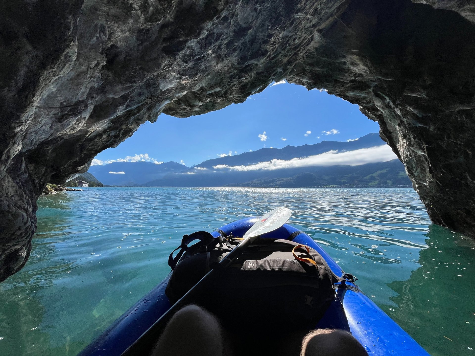
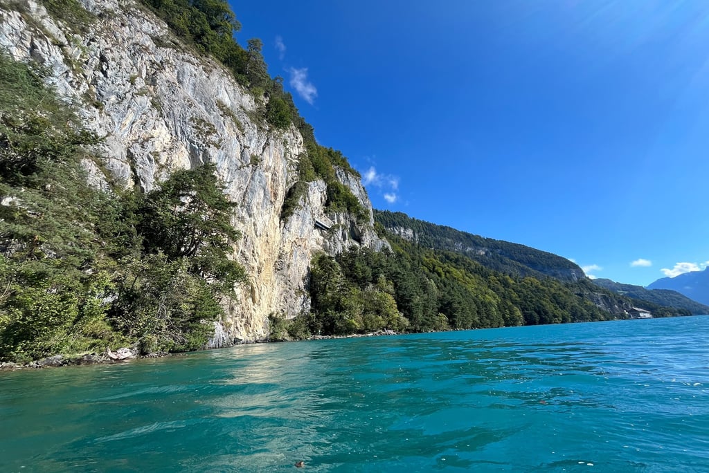
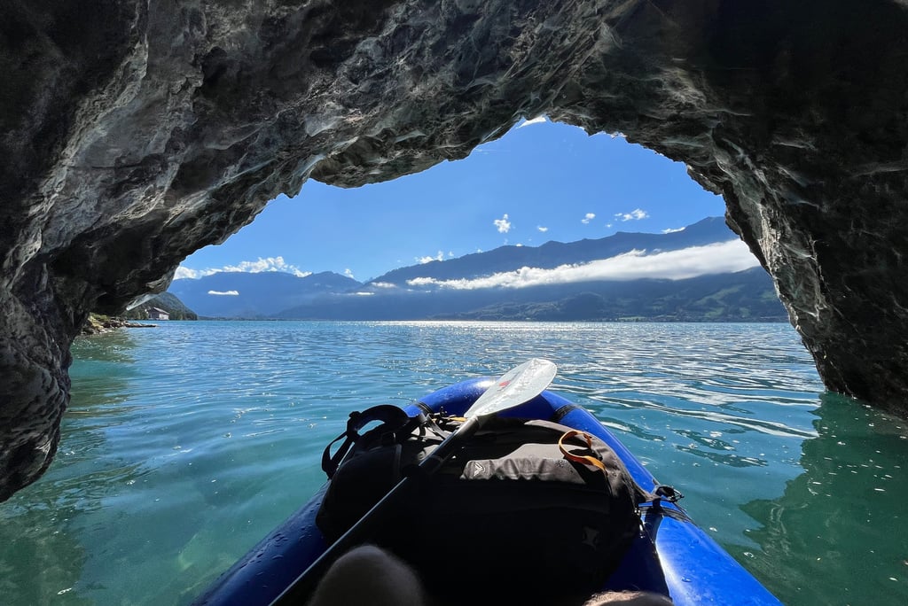
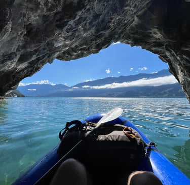
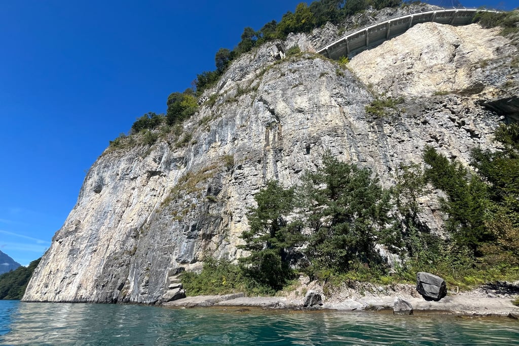
After admiring the view, I curved around Nastel where the forest eventually gives way to increasingly high rock walls and the Balmholz Nature Reserve. From here, the paddle gets a bit more interesting as the cliffs get much higher and you are able to poke your nose into a couple of small sea caves with interesting limestone rock formations.
Unfortunately, the steeper topography in this section of the lake also appealed to the Swiss military from the 1940’s to the 1960’s. The 1947 explosion of an ammunition bunker at Mitholz in the Kandertal (now the focus of a massive effort to remediate the still explosive laden site), led to the Swiss Federal Council ordering the military to dispose of excess munitions.
At that time, the safest (though wildly short-sighted) play was to dump the ammunition into Switzerland’s pristine lakes. Merligen, Beatenbucht, and Balmholz, close to ammunition production and storage sites saw an estimated 4,600 tons of live ammunition, explosive residue from Mitholz, and defective munitions dumped over a 20 year period.
Far lower quantities of munitions also found their way into Lakes Brienz, Lucerne and Geneva.
Today, questions remain about the environmental consequences of these actions. At present, removal of the now rotting munitions is considered to be incredibly dangerous and, luckily based on the depth of lake Thun, they do not pose a significant risk to direct public safety. Yet, the question remains what do we do about the mess we caused? There is currently a sizeable government prize for any effective solution should you have the technological know-how and a good idea!
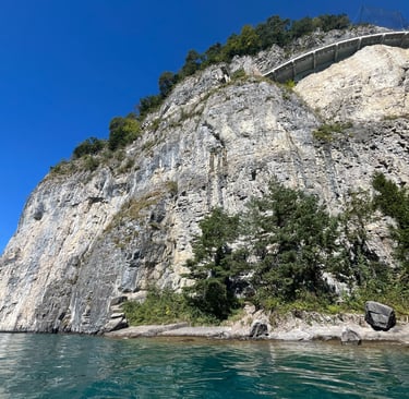
Back to the cliffs, the lake shore road, a modern marvel initially constructed in 1884, weaves through a series of bridges and tunnels to traverse this steep section. Looking up, you can just catch the tops of the cars and busses whizzing through.
To address the lack of access to the small towns along the eastern side of Lake Thun which were still primarily served by boat at the end of the 19th Century, a tram line was constructed along the road grade. From 1905 to 1952, a set of adorable San Francisco cable-car style trams ran between Thun and Interlaken.
With growing maintenance costs (and generally poor construction aimed at saving money), the tram line was forced into retirement in 1952. A trolleybus, or electrified bus line, replaced the tram from 1952 to 1982 after which a regular bus service was put into operation.
The construction of the road in 1884 must have been a bit of a nightmare. The variable geology and topography along the southeastern shores of Lake Thun is incredible though I am not sure they would have realized just how impressive it really is. To a geomorphologist, the topography is quite revealing. The steep, clearly glacially carved topography around the lake, immediately gives way to a much gentler slope flanked at its top and sides by more steep cliffs. From a distance the curved walls, which reach completely around the slope, are a clear indication of a truly massive landslide complex.
Despite my best efforts, I couldn’t find very much information about the Balmholz landslide despite its immense size. The Lake Thun bathymetry shows no evidence for the landslide deposit suggesting that it was obscured by sedimentation or even removed by glaciation. In either case, this likely happened soon after or before the last deglaciation of the Lake Thun basin around 16,000 years ago. The potential presence of moraines on the landslide, as noted by early 20th century geologic investigations, would seem to suggest an even earlier date.
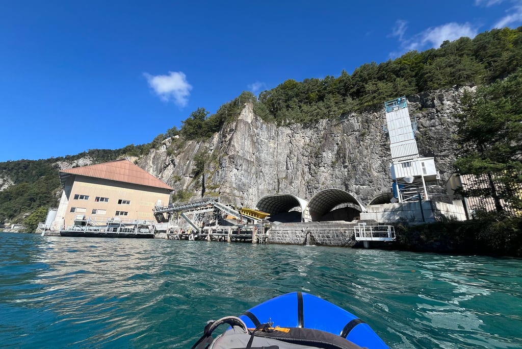
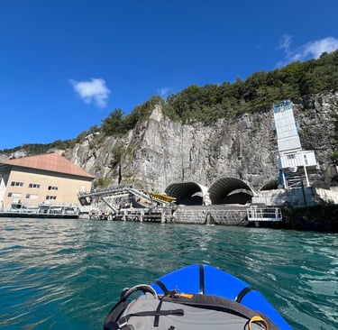
The center of the landslide complex consists of fairly competent rock and is the site of a large quarry operation producing, among other products, ballast for the rail lines all around Switzerland (think the rocks around the railroad ties or sleepers that the rails are affixed to). The facilities for the quarry are readily visible from the water alongside the docks used to transport the ballast onwards to the rail line at Thun. The highwall of the operation itself, dug deep into the ground, is only partially visible from a distance.
A small sea cave in the Balmholz Nature Reserve
Bridges connecting with tunnels in the Balmholz Nature Reserve
A portion of the quarry at the center of the Balmholz Landslide
The Dragon's Lair
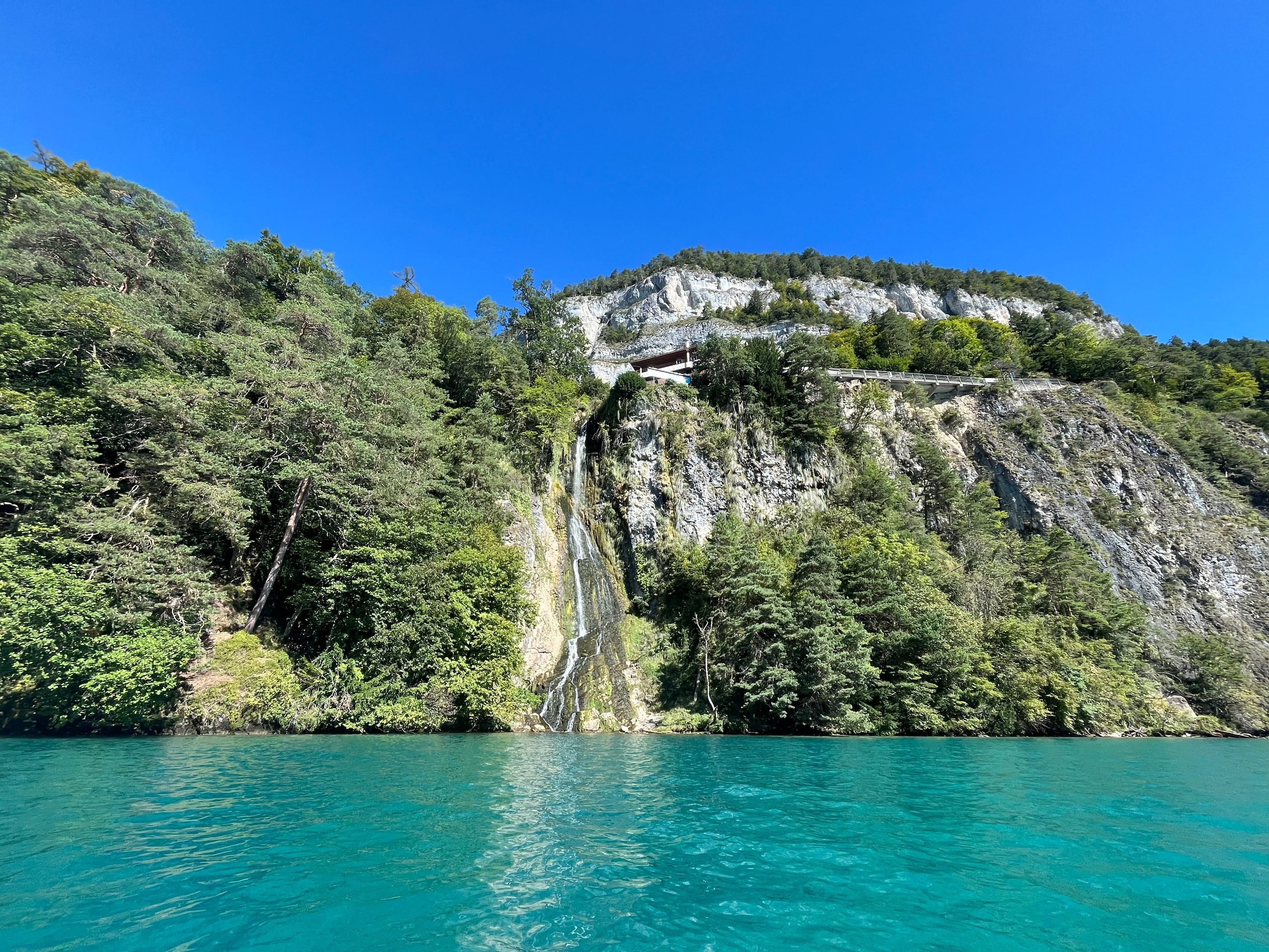
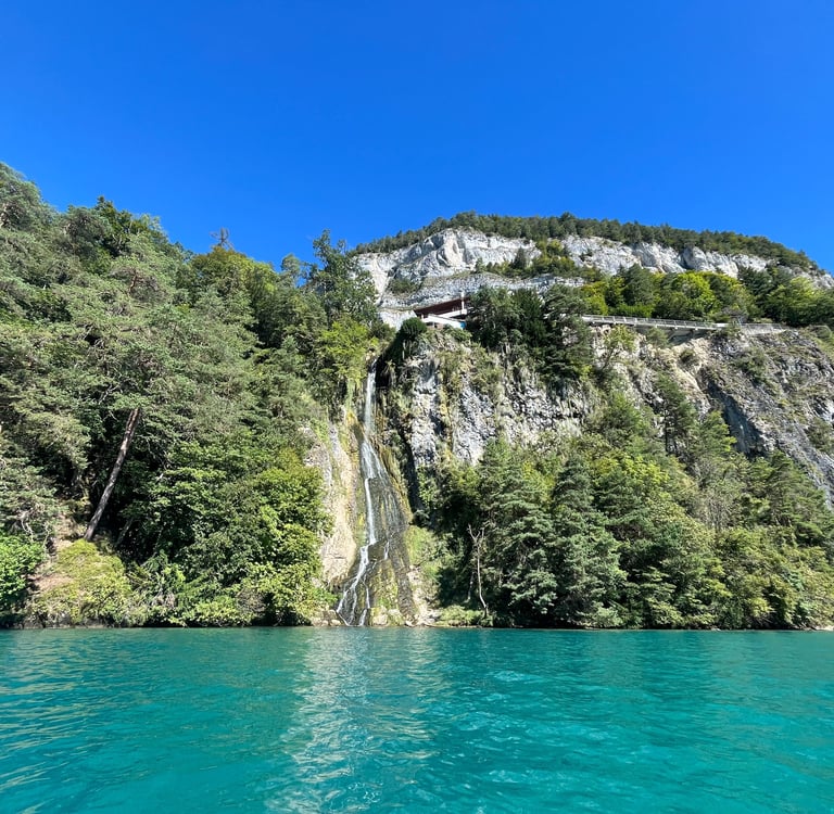
Just past the current workings at Balmholz and a series of older quarry sites, the cliffs steepen back up and a lovely waterfall comes into view. The origin of the water is a large karst system within the limestone above Balmholz, the St. Beatus Cave.
Legend has it that, around the 2nd Century, the residents of Sundlauenen, a tiny hamlet on a large fan delta just up the lake from here (more on that in a bit), were plagued by a fearsome dragon who maliciously set fire to their homes and preyed on their livestock.
Around the same time, yet another persistent Irishmen found his way into the region. Like Galus and Ursicinus, Suetonius had come from the Isles to spread the word of God. Whether by virtue of historical retelling or his own overstated good deeds, Suetonius, who later renamed himself Beatus became a larger-than-life figure.
So, the story goes, looking for a new site for his hermitage, Beatus and his traveling companion agreed to rid Sundlauenen of their cursed dragon in exchange for taking up residence in the beast’s home. Using his magical walking stick imbued with the power of God after a long walk from the coastline, Beatus killed the dragon and sent him to his watery grave at the bottom of Lake Thun (only coincidentally the exact same spot as the five-thousand tons of explosives).
Beatus’ good deeds and conversion of Central Switzerland to Christianity earned him sainthood and he is generally considered the apostle of Switzerland. Even today, the common Swiss name ‘Beat’ is found all around the country.
The Beatus Caves have been a pilgrimage site for Catholics since at least the 13th Century and was the site of a fairly low key religious conflict in the 16th Century following the Reformation. The Protestant Bernese, fed up with the pilgrims, tore down the pilgrimage chapel in 1528, built a protestant church at Beatenberg in 1535, and walled in the cave entrance. Not to be deterred, the Catholic pilgrims (mostly from Obwalden – you might recall the Kapelle Obsee dedicated to Beatus outside of Lungern) simply tore down the wall and continued on their way. The Bernese rebuilt the wall, the Catholics tore it down, and so went the cycle several more times until the flow of pilgrims finally dropped off.
It’s a bit hard to see Beatus Cave unless you get a bit further from the cliffs, but the site is beautiful and worth a visit if you are looking to fill your day after the paddle. There is a direct bus from Neuhaus.
A waterfall coming out the St. Beatus Caves above Lake Thun
Beatus Caves to Neuhaus
Just beyond the waterfall coming from Beatus caves you hit the steepest and tallest rock walls on the paddle. The site is particularly popular with climbers and deep-water soloists who climb without ropes and jump (or fall) from the cliffs into the safety net of the water below. While I won’t directly endorse any of these activities, this site does appear uniquely suited to the activity. The steep limestone cliffs are undercut right at their base allowing you to tuck the boat just beneath the cliff while you climb the wall.
Beyond the cliffs you hit Sundlauenen and the small boat terminal for Beatus Cave (a hell of an uphill walk from there if you are considering it). From Sundlauenen, you curve around a large fan delta extending into the lake, one of the few places where it is possible to easily pull out the boat if you want to take lunch or a snack off the water.
Sundlauenen derives its name from sund referring to the south facing slope and lauenen from the Romansch word lavina meaning mudslide. The constantly changing fan delta is made up of debris flow material washed into the lake by the Sundbach, an ephemeral stream originating high on the slopes between Interlaken and Niederhorn.
While I doubt any of you are planning a paddle in inclement weather, it is important to know that the frequent debris flows from the Sundbach can be incredibly dangerous. I would just avoid stopping at the delta if there is any chance of rain in the forecast.
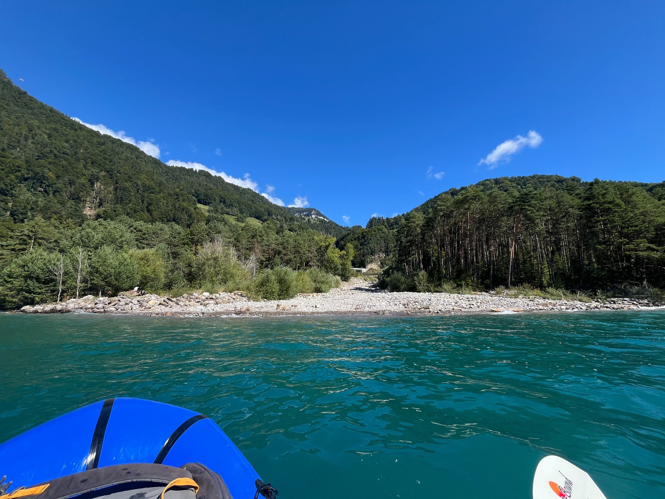
Past the Sundbach, the road finally drops back down to the lake shore and the rest of the paddle is a bit tamer. You pass through a field of moored boats before hitting the end of the lake and, from there, it’s a short paddle around the Lombach delta to get to Neuhaus.
Popular climbing just outside Sundlauenen
The delta of the Sundbach near Sundlauenen
My take out point near Neuhaus
On my latest trip the water level was incredibly high and I was able to pull the boat out in the park at the end of the delta but, if you go a bit further there are several boat ramps around Neuhaus. This is where you can find the paddle rentals as well.
From Neuhaus, its an easy walk to the bus stop or boat station to catch an onward connection. Alternatively, you can make your way back to Interlaken West via the fantastic Weissenau Nature Reserve. It is not legal to paddle through the reserve past Neuhaus so, if you are keen, just head through on foot.
We hope you enjoyed the paddle from Beatenbucht to Neuhaus and that it gave you some inspiration for your next visit to the Berner Oberland. If you are looking for similar posts on the physical and human geography of Switzerland, you will find them in our Into the Alps Series. Until next time, gute reisse and feel free to leave your comments on our Facebook or Instagram pages!